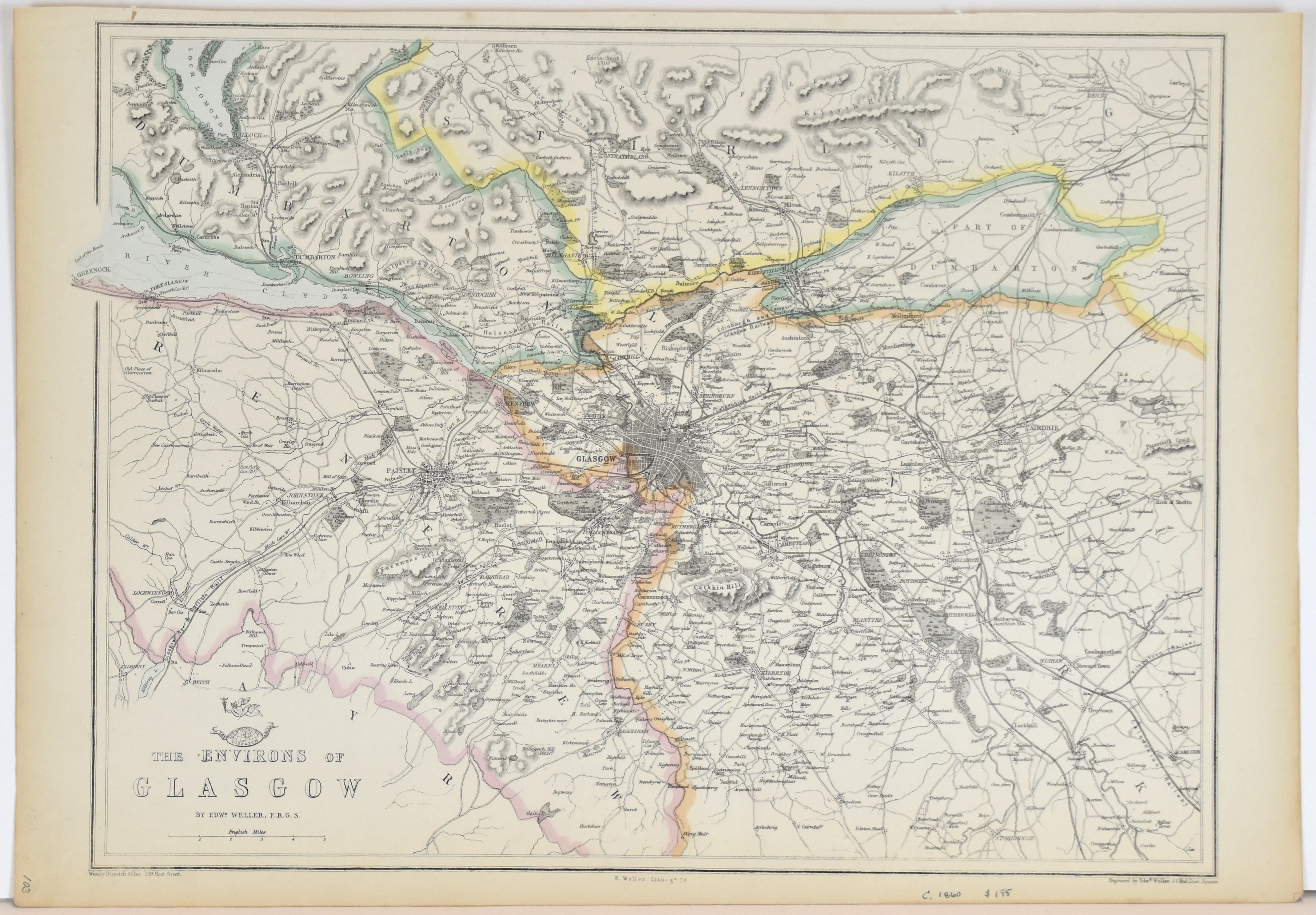
Team Track Map: Houston Belt & Terminal Ry. Co. 1954
- Title: Team Track Map
- Author: Houston Belt & Terminal Ry. Co.
- Date: 1954
- Medium: Lithograph
- Condition: Fair - heavy age toning, fading of image in some areas, separations in margins at folds, slight wear and image loss along folds, few small tears in margins
- Inches: 32 x 30 [Paper]
- Centimeters: 81.28 x 76.2 [Paper]
- Product ID: 317040
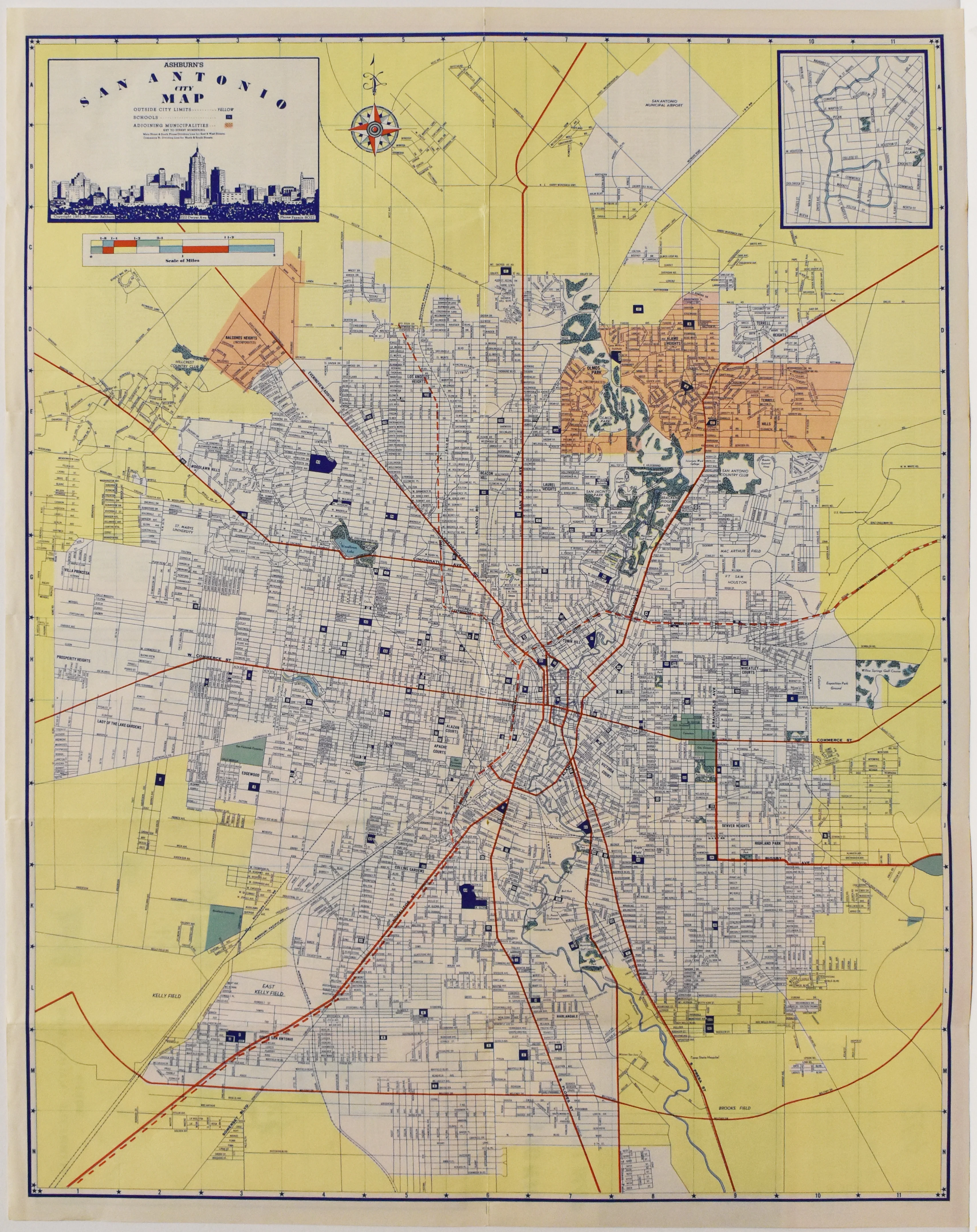
Original map of Houston, Texas from the 1950s showing the various railway lines running in and out of the city. Descriptive legend along bottom margin identifies the various railroad companies, which include Southern Pacific Lines, Gulf Colorado & Santa Fe Ry. Co., Missouri-Kansas-Texas RR Co., Fort Worth & Denver RR, and Missouri Pacific, among others.
- Title: Team Track Map
- Author: Houston Belt & Terminal Ry. Co.
- Date: 1954
- Medium: Lithograph
- Condition: Fair - heavy age toning, fading of image in some areas, separations in margins at folds, slight wear and image loss along folds, few small tears in margins
- Inches: 32 x 30 [Paper]
- Centimeters: 81.28 x 76.2 [Paper]
- Product ID: 317040
Original map of Houston, Texas from the 1950s showing the various railway lines running in and out of the city. Descriptive legend along bottom margin identifies the various railroad companies, which include Southern Pacific Lines, Gulf Colorado & Santa Fe Ry. Co., Missouri-Kansas-Texas RR Co., Fort Worth & Denver RR, and Missouri Pacific, among others.
Original: $150.00
-65%$150.00
$52.50Description
- Title: Team Track Map
- Author: Houston Belt & Terminal Ry. Co.
- Date: 1954
- Medium: Lithograph
- Condition: Fair - heavy age toning, fading of image in some areas, separations in margins at folds, slight wear and image loss along folds, few small tears in margins
- Inches: 32 x 30 [Paper]
- Centimeters: 81.28 x 76.2 [Paper]
- Product ID: 317040
Original map of Houston, Texas from the 1950s showing the various railway lines running in and out of the city. Descriptive legend along bottom margin identifies the various railroad companies, which include Southern Pacific Lines, Gulf Colorado & Santa Fe Ry. Co., Missouri-Kansas-Texas RR Co., Fort Worth & Denver RR, and Missouri Pacific, among others.