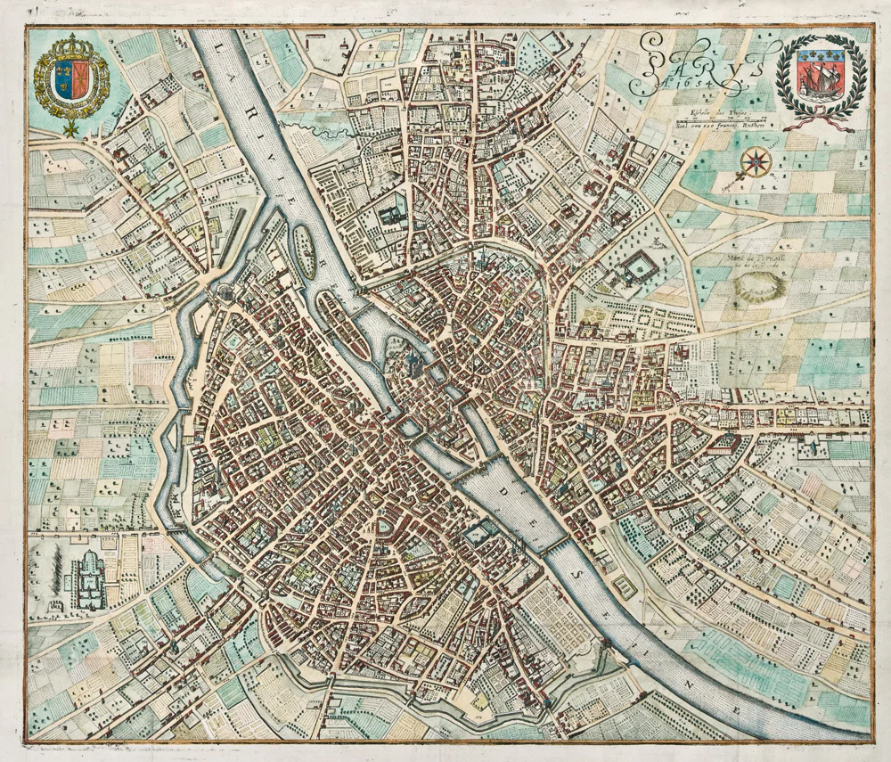
Plan de Paris: Jean, 1802
- Author: Pierre Jean
- Date: 1802
- Medium: Hand-colored engraving
- Condition: A good example on clean paper with sharp engraving and hand outline color, dissected and laid to linen
- Inches: 32 1/2 x 22 1/2
- Centimeters: 82.5 x 57.2
- Product ID: 308153
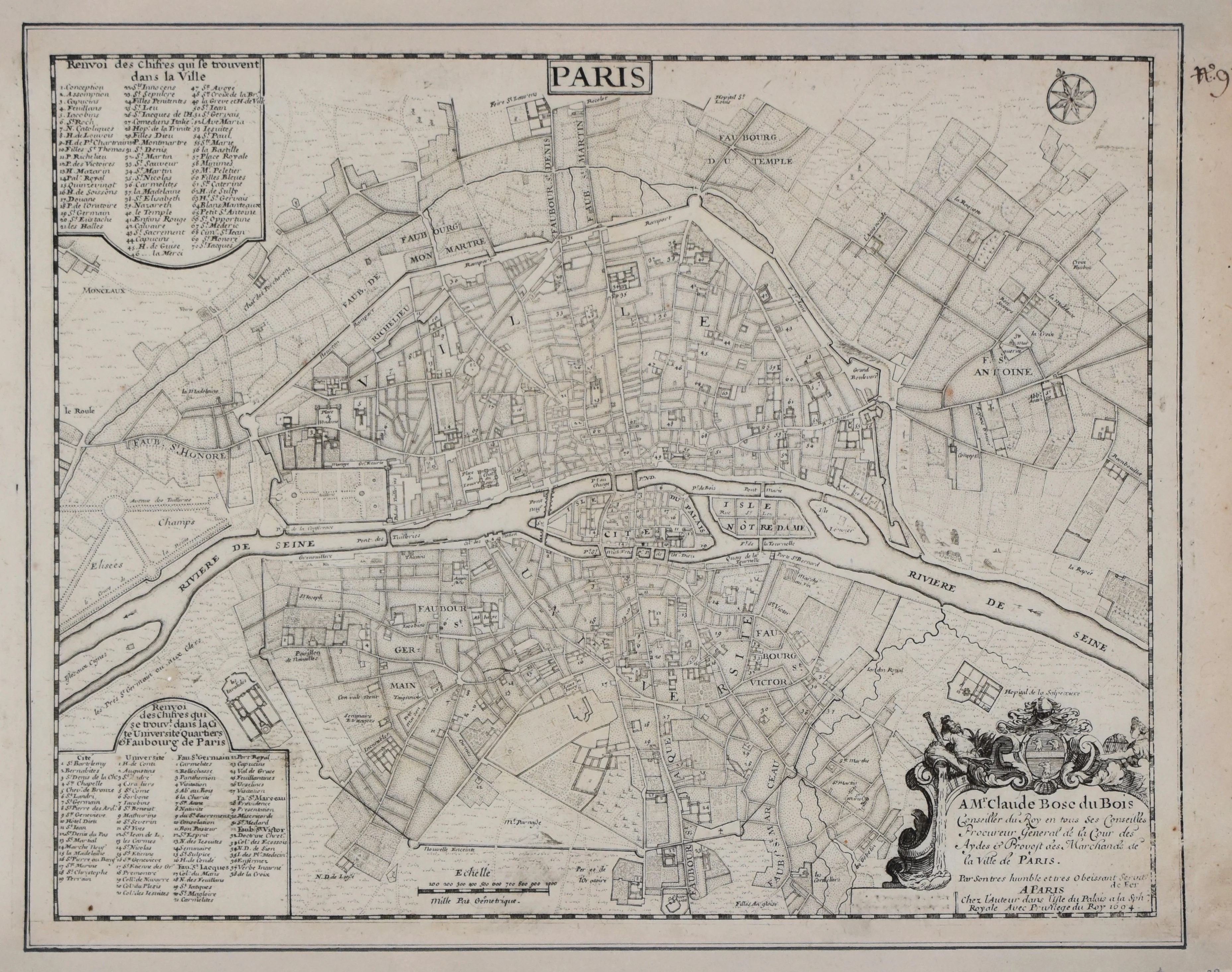
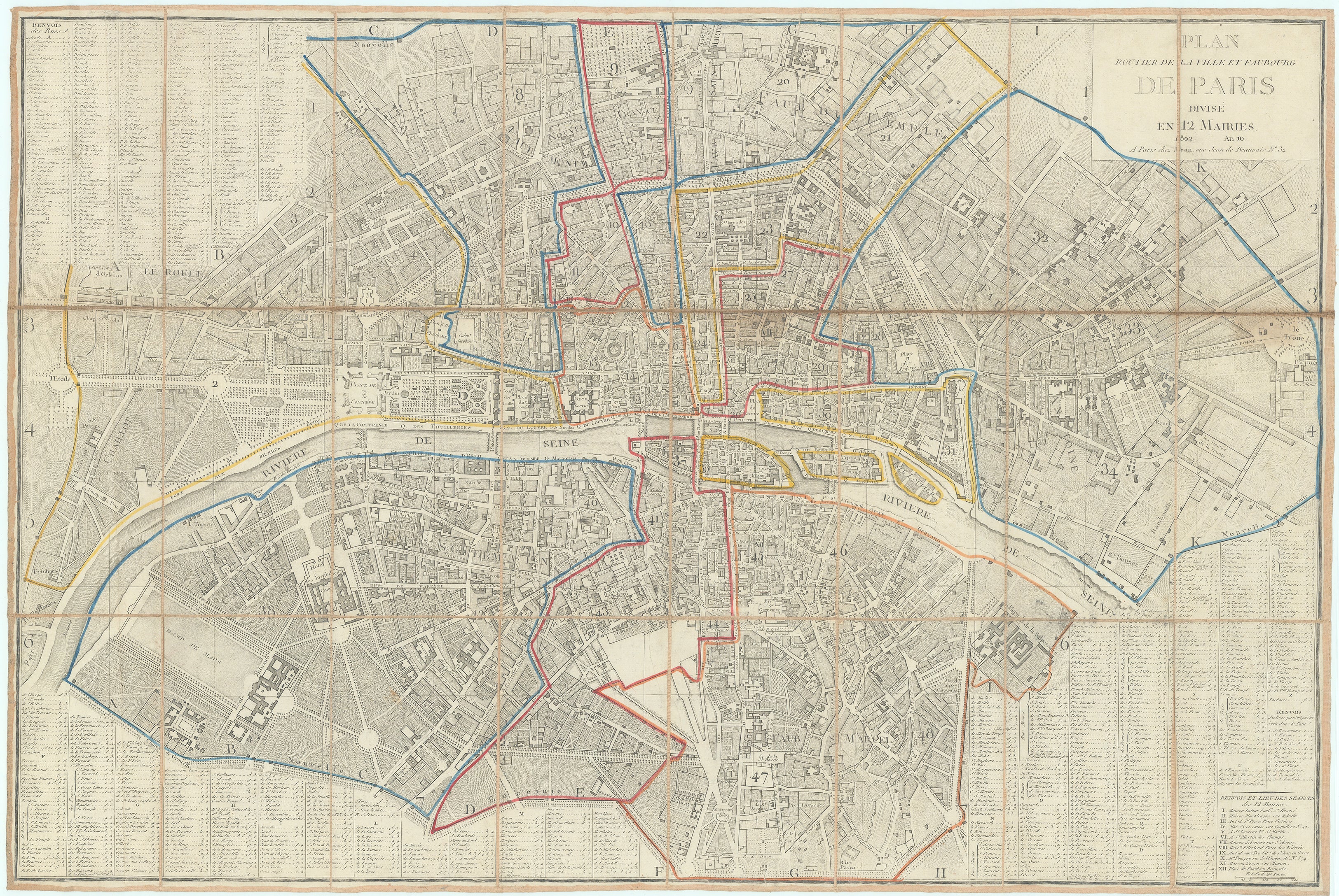
A fine example of the City of Paris divided into twelve municipalities following Napoleon Bonaparte's reorganization of the city in 1800. Including street directories in the bottom and left margins, the piece is beautifully engraved featuring modest outline color delineating the municipalities. Pierre Jean (1754 - 1829) was a prominent Parisian publisher, engraver, as well as print and map seller who was active in Paris during the late 18th and early 19th centuries.
- Author: Pierre Jean
- Date: 1802
- Medium: Hand-colored engraving
- Condition: A good example on clean paper with sharp engraving and hand outline color, dissected and laid to linen
- Inches: 32 1/2 x 22 1/2
- Centimeters: 82.5 x 57.2
- Product ID: 308153
A fine example of the City of Paris divided into twelve municipalities following Napoleon Bonaparte's reorganization of the city in 1800. Including street directories in the bottom and left margins, the piece is beautifully engraved featuring modest outline color delineating the municipalities. Pierre Jean (1754 - 1829) was a prominent Parisian publisher, engraver, as well as print and map seller who was active in Paris during the late 18th and early 19th centuries.
Original: $1,400.00
-65%$1,400.00
$490.00Description
- Author: Pierre Jean
- Date: 1802
- Medium: Hand-colored engraving
- Condition: A good example on clean paper with sharp engraving and hand outline color, dissected and laid to linen
- Inches: 32 1/2 x 22 1/2
- Centimeters: 82.5 x 57.2
- Product ID: 308153
A fine example of the City of Paris divided into twelve municipalities following Napoleon Bonaparte's reorganization of the city in 1800. Including street directories in the bottom and left margins, the piece is beautifully engraved featuring modest outline color delineating the municipalities. Pierre Jean (1754 - 1829) was a prominent Parisian publisher, engraver, as well as print and map seller who was active in Paris during the late 18th and early 19th centuries.