Gray's New Map of Baltimore: Gray 1884
- Title: Gray's New Map of Baltimore
- Author: O. W. Gray & Son
- Date: 1884
- Medium: Hand-colored engraving
- Condition: Very Good - age toning, light foxing, some areas of surface dirt
- Inches: 14 1/2 x 17 3/8 [Paper]
- Centimeters: 36.83 x 44.13 [Paper]
- Product ID: 3110031
Verso: Maryland Delaware and the District of Columbia
Opposite Sheet: Gray's New Map of Richmond Henrico County, Virginia
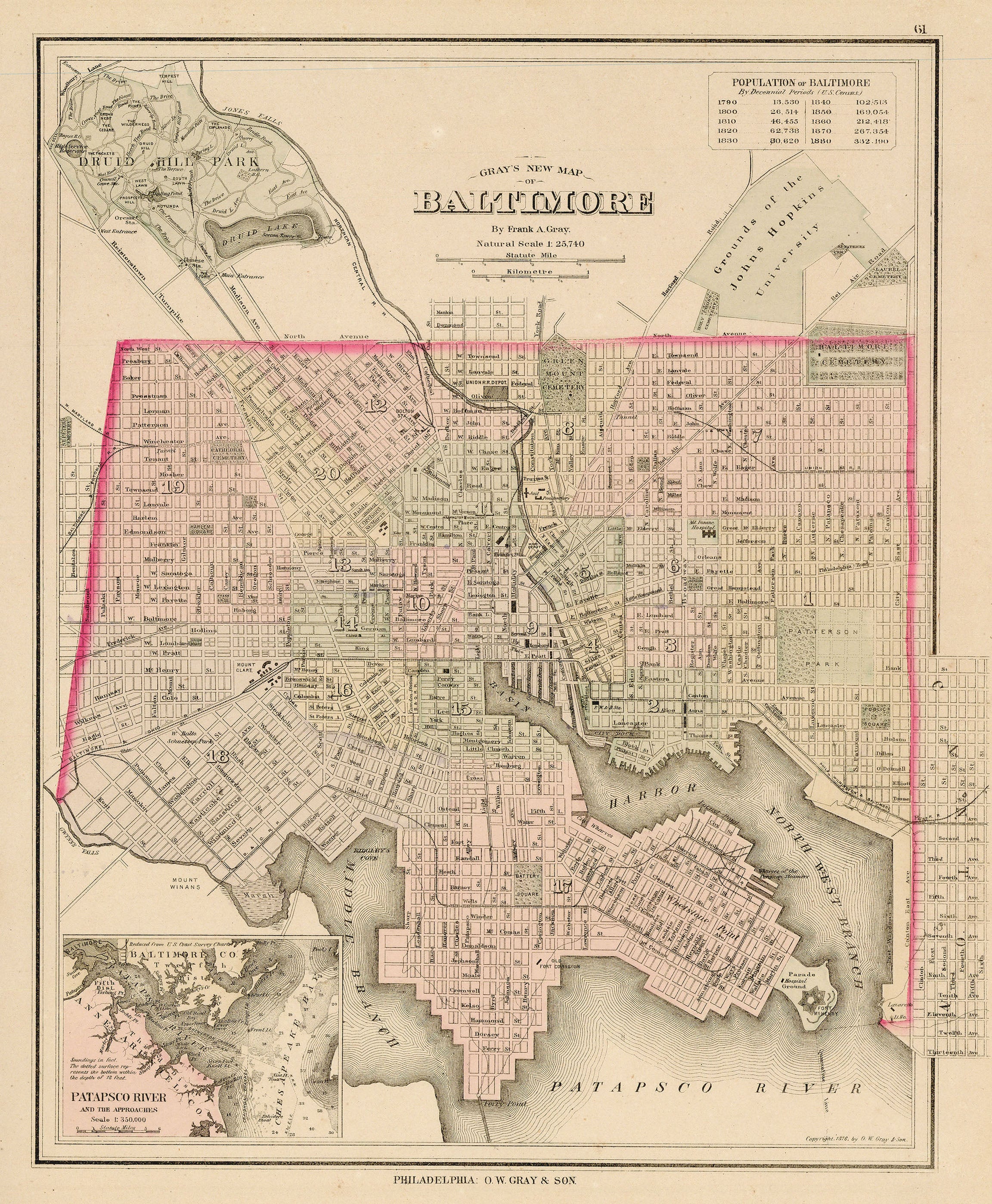
Map of the city of Baltimore, Maryland along the Patapsco River. Features an inset map titled Patapsco River and the Approaches, as well as a chart in the top right demonstrating population growth in the city from 1790 in increments of ten years. North of the city lies Druid Hill Park, as well as the 'Grounds of the Johns Hopkins University.'
- Title: Gray's New Map of Baltimore
- Author: O. W. Gray & Son
- Date: 1884
- Medium: Hand-colored engraving
- Condition: Very Good - age toning, light foxing, some areas of surface dirt
- Inches: 14 1/2 x 17 3/8 [Paper]
- Centimeters: 36.83 x 44.13 [Paper]
- Product ID: 3110031
Verso: Maryland Delaware and the District of Columbia
Opposite Sheet: Gray's New Map of Richmond Henrico County, Virginia
Map of the city of Baltimore, Maryland along the Patapsco River. Features an inset map titled Patapsco River and the Approaches, as well as a chart in the top right demonstrating population growth in the city from 1790 in increments of ten years. North of the city lies Druid Hill Park, as well as the 'Grounds of the Johns Hopkins University.'
Original: $125.00
-65%$125.00
$43.75Description
- Title: Gray's New Map of Baltimore
- Author: O. W. Gray & Son
- Date: 1884
- Medium: Hand-colored engraving
- Condition: Very Good - age toning, light foxing, some areas of surface dirt
- Inches: 14 1/2 x 17 3/8 [Paper]
- Centimeters: 36.83 x 44.13 [Paper]
- Product ID: 3110031
Verso: Maryland Delaware and the District of Columbia
Opposite Sheet: Gray's New Map of Richmond Henrico County, Virginia
Map of the city of Baltimore, Maryland along the Patapsco River. Features an inset map titled Patapsco River and the Approaches, as well as a chart in the top right demonstrating population growth in the city from 1790 in increments of ten years. North of the city lies Druid Hill Park, as well as the 'Grounds of the Johns Hopkins University.'