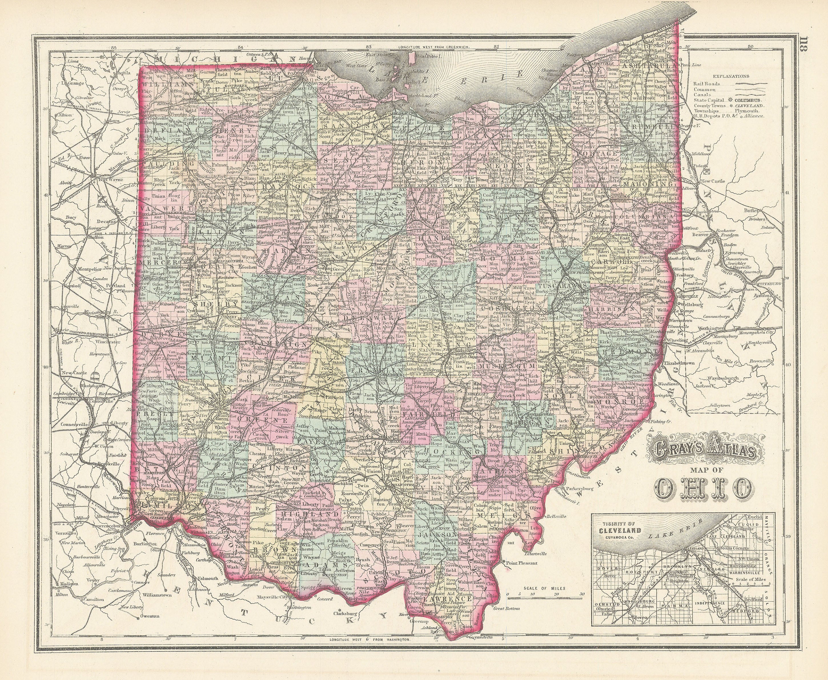
Gray's Atlas Map of Ohio: Gray 1873
- Title: Gray's Atlas Map of Ohio
- Author: O. W. Gray & Son
- Date: 1873
- Medium: Hand-colored engraving
- Condition: Very Good Plus - light age toning, border of slight discoloration from old matting
- Inches: 17 1/4 x 13 3/4 [Paper]
- Centimeters: 43.82 x 34.93 [Paper]
- Product ID: 101305
Map of Ohio divided into counties by publisher O. W. Gray & Son. Shows railroads, canals, depots, and post offices, and contains an inset of Cleveland on the banks of Lake Erie.
Background on Creator
O. W. Gray & Son was a prominent map and atlas publishing firm based in Philadelphia, active in the late nineteenth century. The company was founded by Ormando Wyllis Gray (1829–1912), a civil and topographical engineer. Initially operating as O. W. Gray, the firm later became O. W. Gray & Son as Gray’s son joined the business. They are best known for producing detailed regional, state, and national atlases, including Gray’s National Atlas, which was one of the most commercially successful atlases of the 1870s and among the last to feature hand-colored maps. Their works are recognized for their accuracy, decorative appeal, and historical significance in American cartography.
Description
- Title: Gray's Atlas Map of Ohio
- Author: O. W. Gray & Son
- Date: 1873
- Medium: Hand-colored engraving
- Condition: Very Good Plus - light age toning, border of slight discoloration from old matting
- Inches: 17 1/4 x 13 3/4 [Paper]
- Centimeters: 43.82 x 34.93 [Paper]
- Product ID: 101305
Map of Ohio divided into counties by publisher O. W. Gray & Son. Shows railroads, canals, depots, and post offices, and contains an inset of Cleveland on the banks of Lake Erie.
Background on Creator
O. W. Gray & Son was a prominent map and atlas publishing firm based in Philadelphia, active in the late nineteenth century. The company was founded by Ormando Wyllis Gray (1829–1912), a civil and topographical engineer. Initially operating as O. W. Gray, the firm later became O. W. Gray & Son as Gray’s son joined the business. They are best known for producing detailed regional, state, and national atlases, including Gray’s National Atlas, which was one of the most commercially successful atlases of the 1870s and among the last to feature hand-colored maps. Their works are recognized for their accuracy, decorative appeal, and historical significance in American cartography.