✨ New Arrivals Just Dropped!Explore
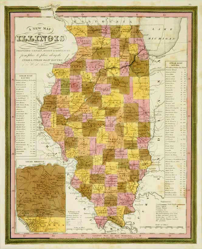
Illinois: Johnson 1864
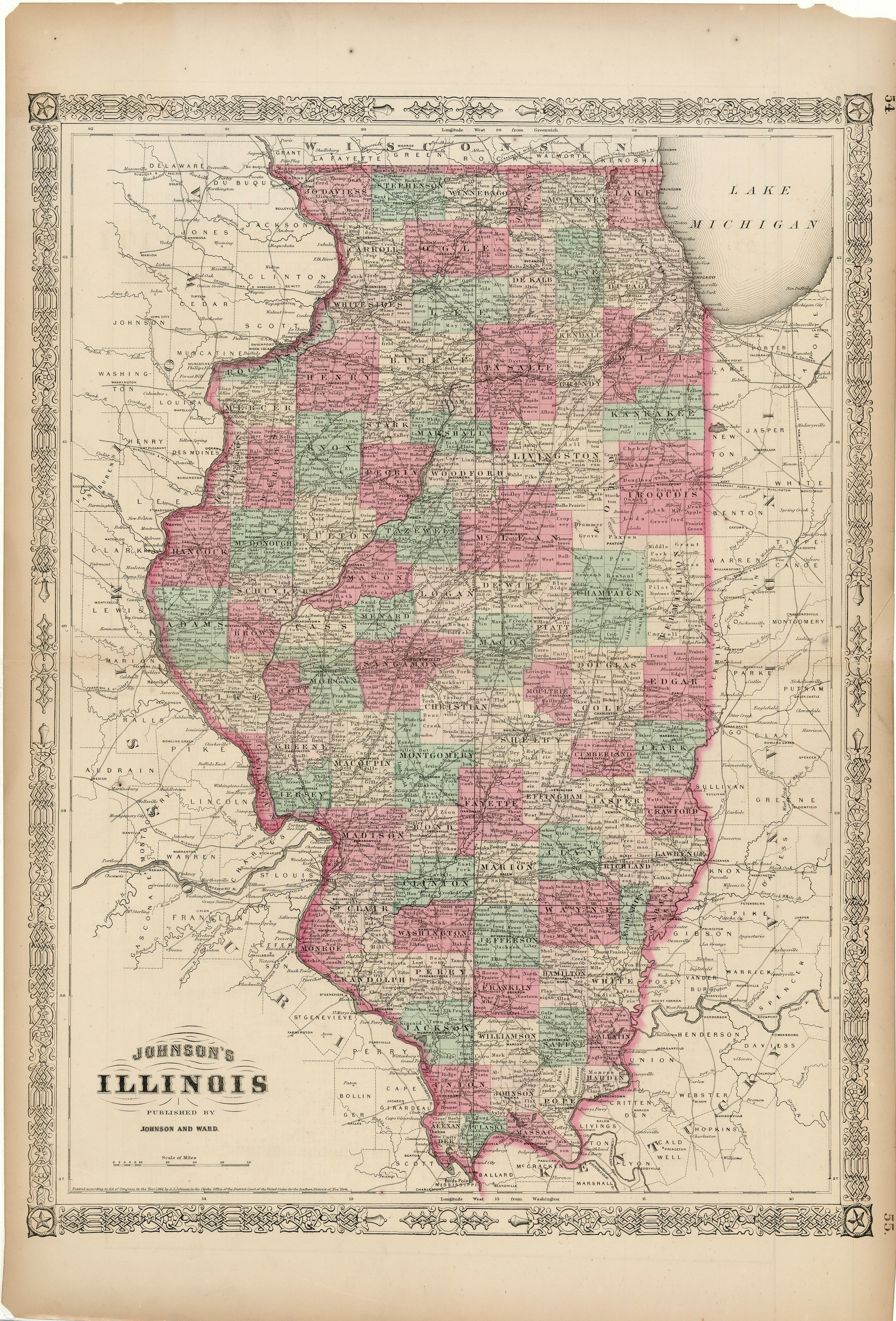
- Title: Illinois
- Author: A. J. Johnson
- Date: 1864
- Medium: Hand-colored lithograph
- Condition: Very Good - age toning, issued center fold, paper loss in corners and margins, light foxing
- Inches: 18 1/8 x 26 5/8 [Paper]
- Centimeters: 46.04 x 67.63 [Paper]
- Product ID: 222020
Map of Illinois in its various counties. Includes parts of Missouri, Iowa, Indiana, Kentucky, Wisconsin, and Lake Michigan. Map labels cities such as Chicago and Springfield, as well as railroad lines and major topographical features.
$92.75
Original: $265.00
-65%Illinois: Johnson 1864—
$265.00
$92.75Description
- Title: Illinois
- Author: A. J. Johnson
- Date: 1864
- Medium: Hand-colored lithograph
- Condition: Very Good - age toning, issued center fold, paper loss in corners and margins, light foxing
- Inches: 18 1/8 x 26 5/8 [Paper]
- Centimeters: 46.04 x 67.63 [Paper]
- Product ID: 222020
Map of Illinois in its various counties. Includes parts of Missouri, Iowa, Indiana, Kentucky, Wisconsin, and Lake Michigan. Map labels cities such as Chicago and Springfield, as well as railroad lines and major topographical features.