View of Kilauea From The Volcano House: U.S. Geological Survey 1883
- Author: U.S. Geological Survey
- Date: 1883
- Medium: Wax engraving
- Condition: Very Good + - Folds as issued
- Inches: 18 x 11.5
- Centimeters: 45.7 x 29.2
- Product ID: 306021
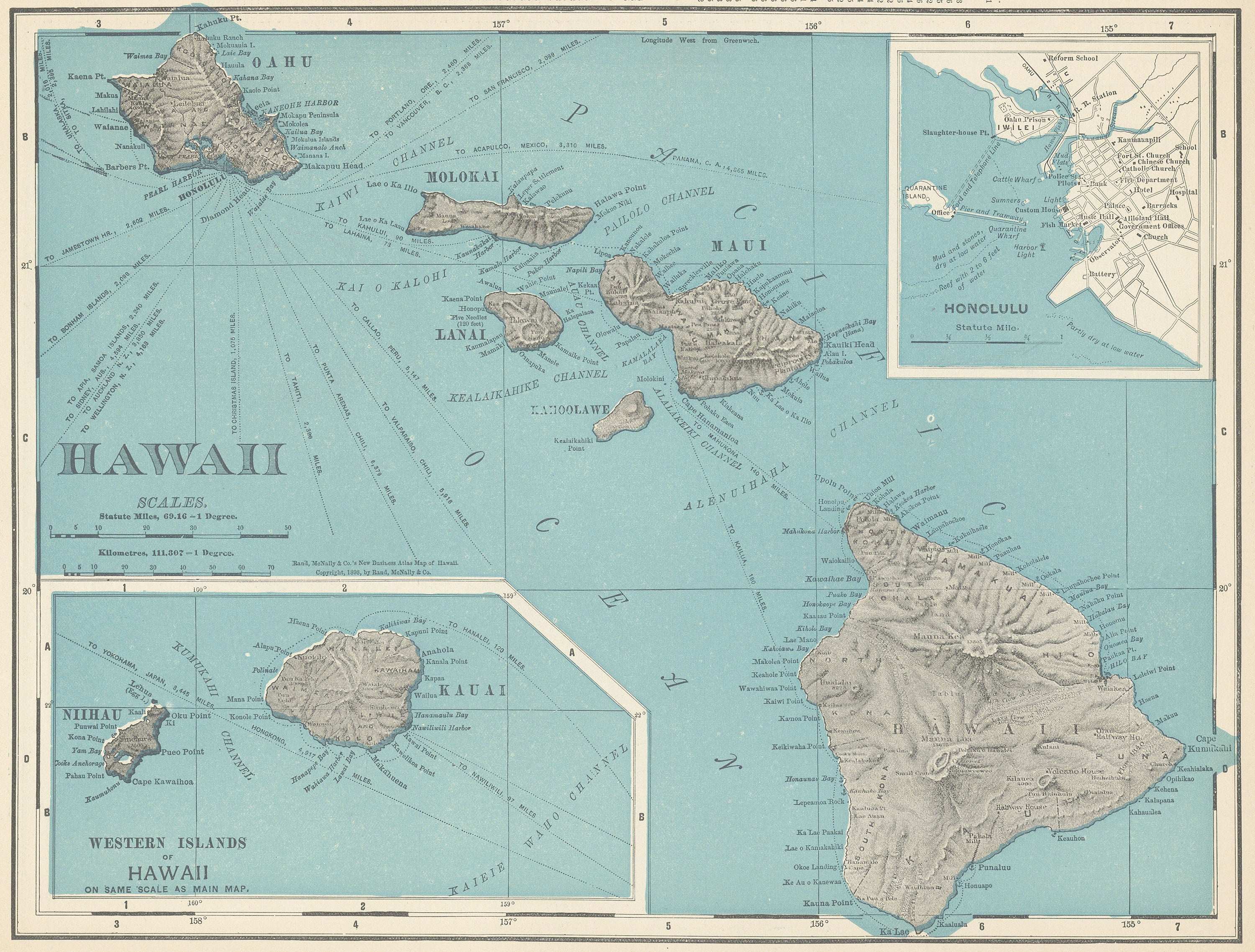
View of Kilauea From The Volcano House, Hawaii.
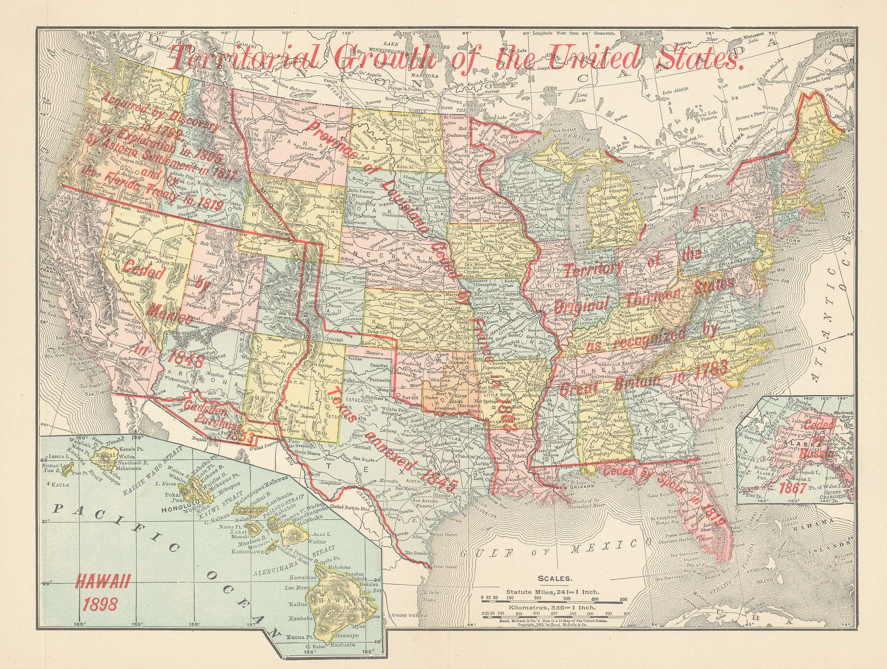
The USGS was created by an act of Congress on March 3, 1879, and charged with the "classification of the public lands, and examination of the geological structure, mineral resources, and products of the national domain". This task was driven by the need to inventory the vast lands added to the United States by the Louisiana Purchase in 1803 and the Mexican–American War in 1848. The legislation also provided that the Hayden, Powell, and Wheeler surveys be discontinued as of June 30, 1879.
- Author: U.S. Geological Survey
- Date: 1883
- Medium: Wax engraving
- Condition: Very Good + - Folds as issued
- Inches: 18 x 11.5
- Centimeters: 45.7 x 29.2
- Product ID: 306021
View of Kilauea From The Volcano House, Hawaii.
The USGS was created by an act of Congress on March 3, 1879, and charged with the "classification of the public lands, and examination of the geological structure, mineral resources, and products of the national domain". This task was driven by the need to inventory the vast lands added to the United States by the Louisiana Purchase in 1803 and the Mexican–American War in 1848. The legislation also provided that the Hayden, Powell, and Wheeler surveys be discontinued as of June 30, 1879.
Original: $95.00
-65%$95.00
$33.25Description
- Author: U.S. Geological Survey
- Date: 1883
- Medium: Wax engraving
- Condition: Very Good + - Folds as issued
- Inches: 18 x 11.5
- Centimeters: 45.7 x 29.2
- Product ID: 306021
View of Kilauea From The Volcano House, Hawaii.
The USGS was created by an act of Congress on March 3, 1879, and charged with the "classification of the public lands, and examination of the geological structure, mineral resources, and products of the national domain". This task was driven by the need to inventory the vast lands added to the United States by the Louisiana Purchase in 1803 and the Mexican–American War in 1848. The legislation also provided that the Hayden, Powell, and Wheeler surveys be discontinued as of June 30, 1879.