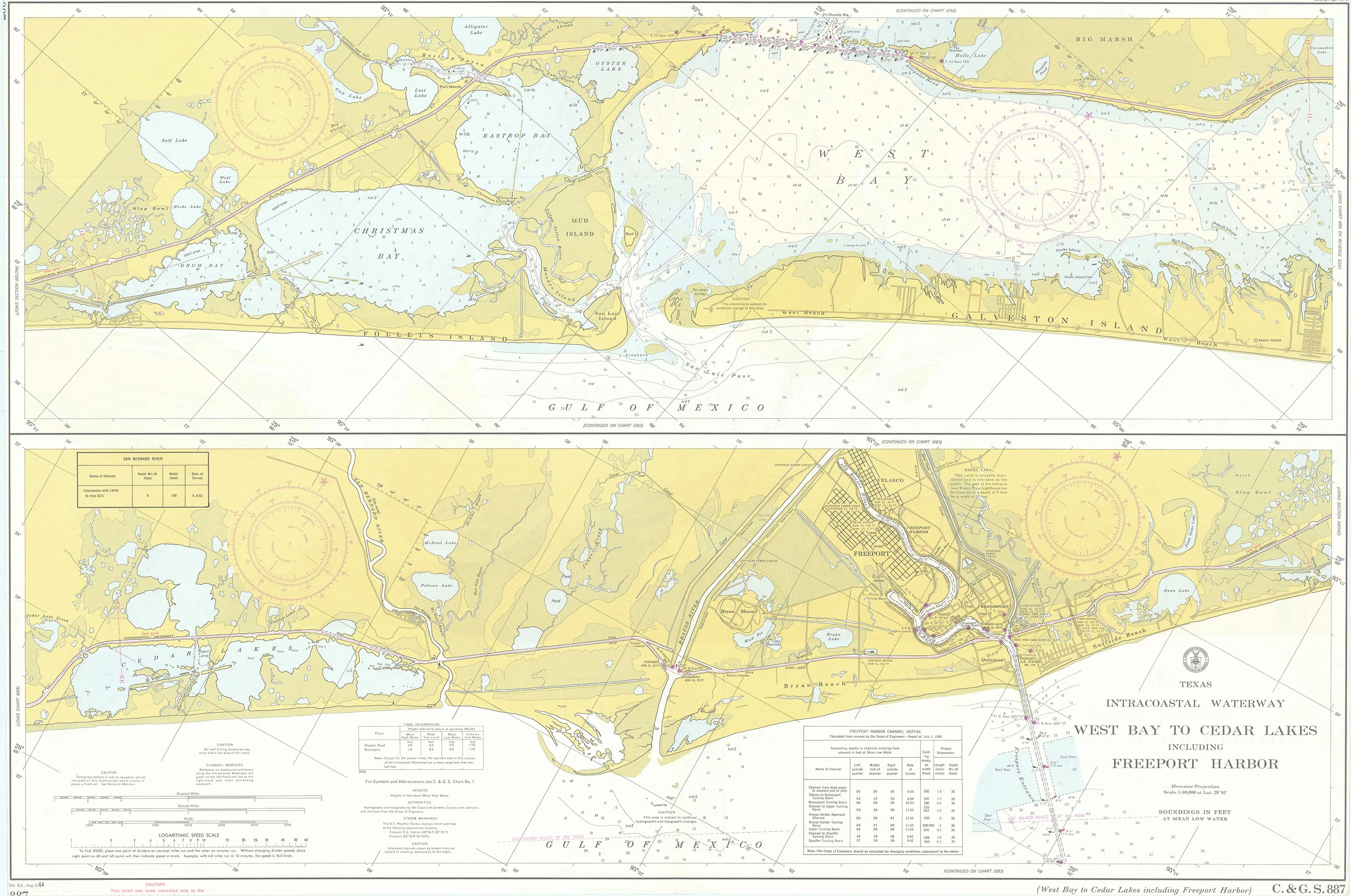
Texas Intracoastal Waterway West Bay to Cedar Lakes Including Freeport Harbor: U. S. Coast and Geodetic Survey 1964
- Title: Texas Intracoastal Waterway West Bay to Cedar Lakes Including Freeport Harbor
- Author: U. S. Coast and Geodetic Survey
- Date: 1964
- Medium: Chromolithograph
- Condition: Excellent - vertical center fold
- Inches: 36 5/8 x 24 5/8 [Paper]
- Centimeters: 93.03 x 62.55 [Paper]
- Product ID: 318062
Map of the Texas Intracoastal Waterway in two parts. Includes Christmas Bay, Galveston Island, the Brazos River, and the city of Freeport, Texas. Map shows the railroad network of the region and lists information related to oil pipelines and wells, underwater cables, water depths, magnetic variation, tides and currents, and climate and terrain.
Description
- Title: Texas Intracoastal Waterway West Bay to Cedar Lakes Including Freeport Harbor
- Author: U. S. Coast and Geodetic Survey
- Date: 1964
- Medium: Chromolithograph
- Condition: Excellent - vertical center fold
- Inches: 36 5/8 x 24 5/8 [Paper]
- Centimeters: 93.03 x 62.55 [Paper]
- Product ID: 318062
Map of the Texas Intracoastal Waterway in two parts. Includes Christmas Bay, Galveston Island, the Brazos River, and the city of Freeport, Texas. Map shows the railroad network of the region and lists information related to oil pipelines and wells, underwater cables, water depths, magnetic variation, tides and currents, and climate and terrain.