Texas Fields and Geological Structures: The Oil and Gas Journal 1954
-
Title: Texas Fields and Geological Structures
- Author: The Oil and Gas Journal
- Date: 1954
- Medium: Chromolithograph
- Condition: Very Good Plus - creasing and minor marginal separations at folds, tear in upper right margin
- Inches: 45 x 35 [Image]
- Centimeters: 114.3 x 88.9 [Image]
- Product ID: 318002
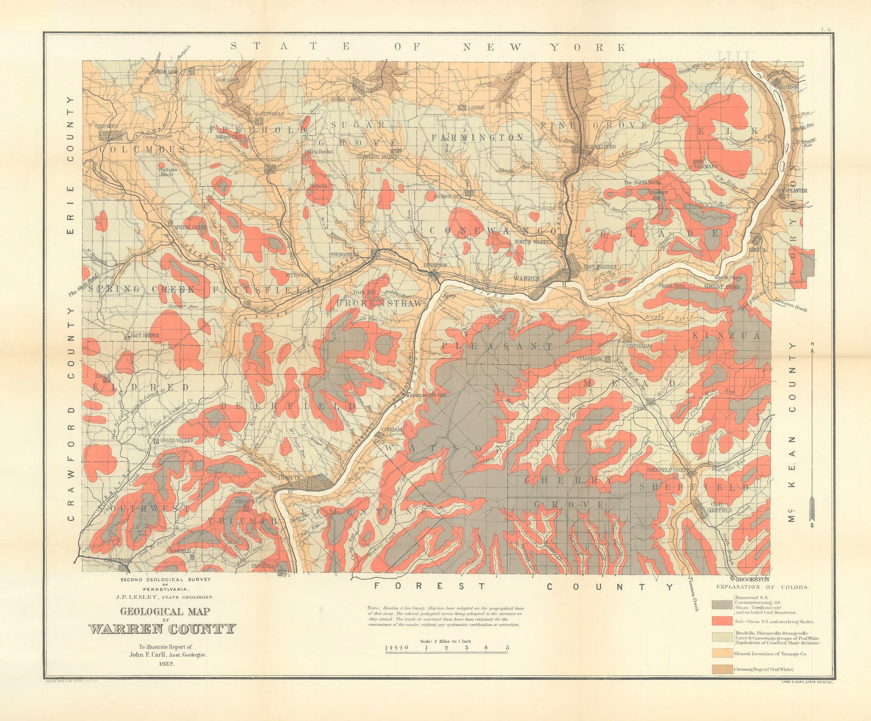
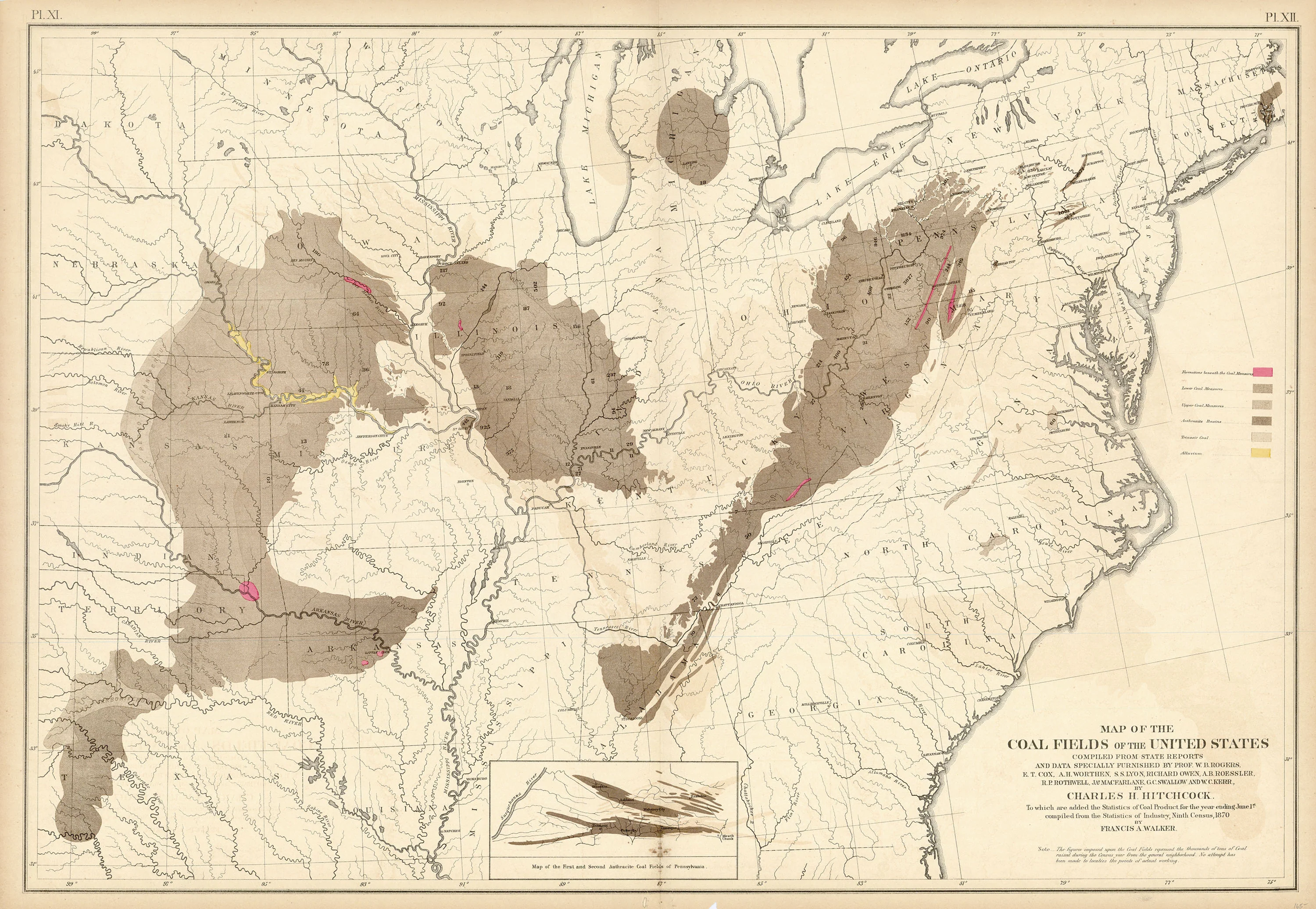
This map was prepared to provide an objective look at the effect of regional geology on oil and gas accumulation. By superimposing a surface oil field map upon a subsurface map showing the major structural features of Texas, a striking illustration of the relationship between structure and accumulation is achieved.
Those structural features that have had a direct impact in producing the environment necessary for the formation of oil pools are described briefly below; major features that have had an indirect effect or possess geological interest only are outlined on the map without further description.
Large scale colorful map illustrating the various oil fields and geologic structures of Texas. Includes a legend explaining the characteristics and specifics of each geological region of the state. Distinct regions labeled include:
- Vicksburg Flexure
- Mirando Shoreline
- Gulf Coast Salt Dome Embayment
- East Texas Embayment
- Sabine Uplift
- Tyler Basin
- Luling-Mexia-Talco Fault Zone
- Balcones Fault Zone
- Bend Arch
- Ft. Worth Syncline
- Red River Uplift
- Plainview-Palo Duro Basin
- Matador Arch
- Central Plains Platform
- Delaware Basin
- Marathon Uplift
- Solitario Uplift
- Marfa Basin
- Diablo Plateau
- Hueco Basin
- Permian Basin
- Northwestern Shelf
- Eastern Platform
- Midland Basin
- Rio Grande Embayment
- Llano Uplift
- Dalhart Basin
- Amarillo Uplift
- Andarko Basin
-
Title: Texas Fields and Geological Structures
- Author: The Oil and Gas Journal
- Date: 1954
- Medium: Chromolithograph
- Condition: Very Good Plus - creasing and minor marginal separations at folds, tear in upper right margin
- Inches: 45 x 35 [Image]
- Centimeters: 114.3 x 88.9 [Image]
- Product ID: 318002
This map was prepared to provide an objective look at the effect of regional geology on oil and gas accumulation. By superimposing a surface oil field map upon a subsurface map showing the major structural features of Texas, a striking illustration of the relationship between structure and accumulation is achieved.
Those structural features that have had a direct impact in producing the environment necessary for the formation of oil pools are described briefly below; major features that have had an indirect effect or possess geological interest only are outlined on the map without further description.
Large scale colorful map illustrating the various oil fields and geologic structures of Texas. Includes a legend explaining the characteristics and specifics of each geological region of the state. Distinct regions labeled include:
- Vicksburg Flexure
- Mirando Shoreline
- Gulf Coast Salt Dome Embayment
- East Texas Embayment
- Sabine Uplift
- Tyler Basin
- Luling-Mexia-Talco Fault Zone
- Balcones Fault Zone
- Bend Arch
- Ft. Worth Syncline
- Red River Uplift
- Plainview-Palo Duro Basin
- Matador Arch
- Central Plains Platform
- Delaware Basin
- Marathon Uplift
- Solitario Uplift
- Marfa Basin
- Diablo Plateau
- Hueco Basin
- Permian Basin
- Northwestern Shelf
- Eastern Platform
- Midland Basin
- Rio Grande Embayment
- Llano Uplift
- Dalhart Basin
- Amarillo Uplift
- Andarko Basin
Description
-
Title: Texas Fields and Geological Structures
- Author: The Oil and Gas Journal
- Date: 1954
- Medium: Chromolithograph
- Condition: Very Good Plus - creasing and minor marginal separations at folds, tear in upper right margin
- Inches: 45 x 35 [Image]
- Centimeters: 114.3 x 88.9 [Image]
- Product ID: 318002
This map was prepared to provide an objective look at the effect of regional geology on oil and gas accumulation. By superimposing a surface oil field map upon a subsurface map showing the major structural features of Texas, a striking illustration of the relationship between structure and accumulation is achieved.
Those structural features that have had a direct impact in producing the environment necessary for the formation of oil pools are described briefly below; major features that have had an indirect effect or possess geological interest only are outlined on the map without further description.
Large scale colorful map illustrating the various oil fields and geologic structures of Texas. Includes a legend explaining the characteristics and specifics of each geological region of the state. Distinct regions labeled include:
- Vicksburg Flexure
- Mirando Shoreline
- Gulf Coast Salt Dome Embayment
- East Texas Embayment
- Sabine Uplift
- Tyler Basin
- Luling-Mexia-Talco Fault Zone
- Balcones Fault Zone
- Bend Arch
- Ft. Worth Syncline
- Red River Uplift
- Plainview-Palo Duro Basin
- Matador Arch
- Central Plains Platform
- Delaware Basin
- Marathon Uplift
- Solitario Uplift
- Marfa Basin
- Diablo Plateau
- Hueco Basin
- Permian Basin
- Northwestern Shelf
- Eastern Platform
- Midland Basin
- Rio Grande Embayment
- Llano Uplift
- Dalhart Basin
- Amarillo Uplift
- Andarko Basin