Starr County - Texas General Land Office Map ca. 1926
- Title: Starr Co.
- Author: Texas General Land Office
- Date: ca. 1925
- Medium: Lithograph
- Condition: Very good
- Inches: 14 x 17 [Paper]
- Centimeters: 35.56 x 43.18 [Paper]
- Product ID: 3112203
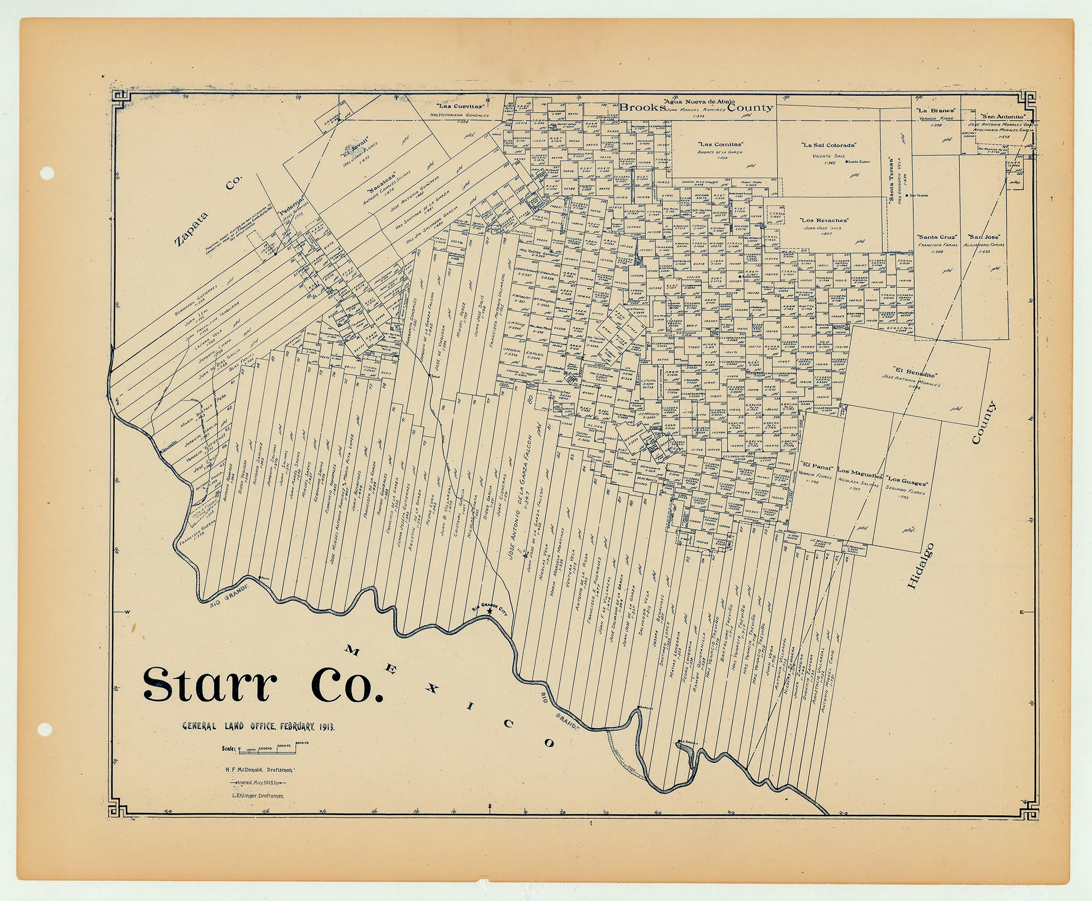
Antique Texas county map published ca. 1925 by Wolf & Bennett for the Texas General Land Office. General Land Office maps show land patents, block and tract numbers, landowners, towns, railroads, and portions of adjacent counties where property boundaries extend beyond county limits.
This map shows Starr County, est. 1848. The county seat of Rio Grande City is shown at bottom center, on the Rio Grande border with Mexico. Starr county is bordered by Brooks, Hidalgo, and Zapata counties.
Survey date – 1913
Condition Notes:
- Uniform age toning, a bit darker along edges, paper somewhat fragile, original binding holes present.
- Minimal marginal chipping
- Very good overall condition.
- Title: Starr Co.
- Author: Texas General Land Office
- Date: ca. 1925
- Medium: Lithograph
- Condition: Very good
- Inches: 14 x 17 [Paper]
- Centimeters: 35.56 x 43.18 [Paper]
- Product ID: 3112203
Antique Texas county map published ca. 1925 by Wolf & Bennett for the Texas General Land Office. General Land Office maps show land patents, block and tract numbers, landowners, towns, railroads, and portions of adjacent counties where property boundaries extend beyond county limits.
This map shows Starr County, est. 1848. The county seat of Rio Grande City is shown at bottom center, on the Rio Grande border with Mexico. Starr county is bordered by Brooks, Hidalgo, and Zapata counties.
Survey date – 1913
Condition Notes:
- Uniform age toning, a bit darker along edges, paper somewhat fragile, original binding holes present.
- Minimal marginal chipping
- Very good overall condition.
Description
- Title: Starr Co.
- Author: Texas General Land Office
- Date: ca. 1925
- Medium: Lithograph
- Condition: Very good
- Inches: 14 x 17 [Paper]
- Centimeters: 35.56 x 43.18 [Paper]
- Product ID: 3112203
Antique Texas county map published ca. 1925 by Wolf & Bennett for the Texas General Land Office. General Land Office maps show land patents, block and tract numbers, landowners, towns, railroads, and portions of adjacent counties where property boundaries extend beyond county limits.
This map shows Starr County, est. 1848. The county seat of Rio Grande City is shown at bottom center, on the Rio Grande border with Mexico. Starr county is bordered by Brooks, Hidalgo, and Zapata counties.
Survey date – 1913
Condition Notes:
- Uniform age toning, a bit darker along edges, paper somewhat fragile, original binding holes present.
- Minimal marginal chipping
- Very good overall condition.