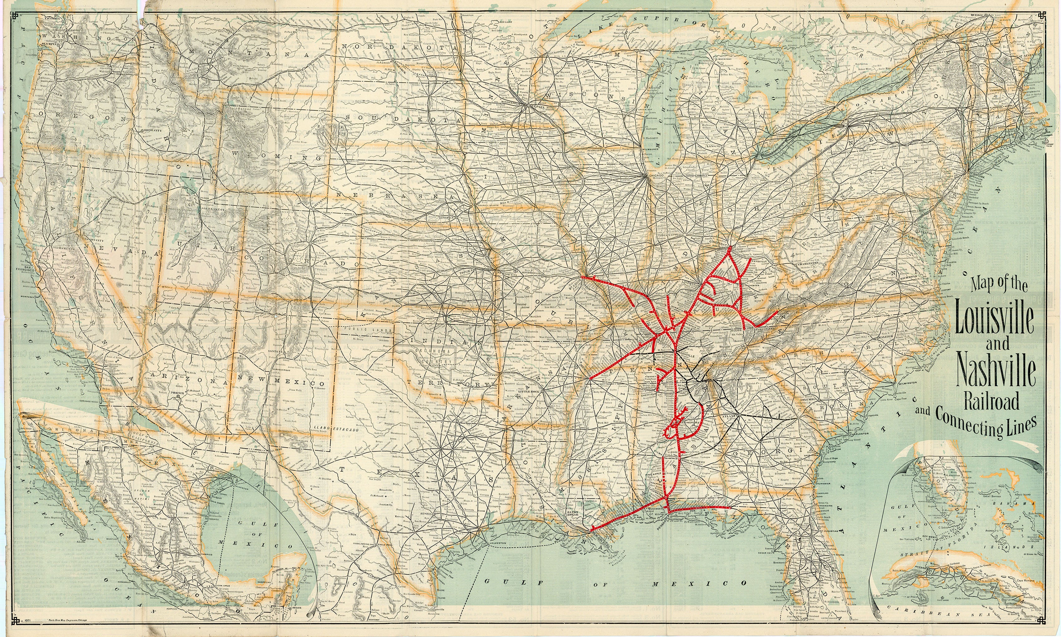
Map of the Louisville and Nashville Railroad and Connecting Lines: Louisville and Nashville Railroad 1891
- Title: Map of the Louisville and Nashville Railroad and Connecting Lines
-
Author: Louisville and Nashville Railroad
- Date: 1891
- Medium: Wax engraving
- Condition: Very Good - light age toning, slight paper loss at issued folds
- Inches: 32.5 x 20 [Paper]
- Centimeters: 90.1 x 50.8 [Paper]
- Product ID: 307015
The L&N was chartered on March 5, 1850 by the Commonwealth of Kentucky to build a railroad between Louisville, Kentucky and Nashville, Tennessee. Construction began in 1853, and the first train operated between the two namesake cities on October 27, 1859.
The L&N was very well known throughout its existence for being both profitable as well as reliable, even garnering the nickname "The Old Reliable" as a result of its consistent operations. In 1971 the Seaboard Coast Line Railroad acquired full ownership of the L&N and by 1982, it was fully absorbed into the Seaboard system.
The Louisville and Nashville Railroad played a crucial role in the development of rail transportation in the Southeast, leaving a lasting impact on the region's economic and transportation history.
Original: $1,395.00
-65%$1,395.00
$488.25Description
- Title: Map of the Louisville and Nashville Railroad and Connecting Lines
-
Author: Louisville and Nashville Railroad
- Date: 1891
- Medium: Wax engraving
- Condition: Very Good - light age toning, slight paper loss at issued folds
- Inches: 32.5 x 20 [Paper]
- Centimeters: 90.1 x 50.8 [Paper]
- Product ID: 307015
The L&N was chartered on March 5, 1850 by the Commonwealth of Kentucky to build a railroad between Louisville, Kentucky and Nashville, Tennessee. Construction began in 1853, and the first train operated between the two namesake cities on October 27, 1859.
The L&N was very well known throughout its existence for being both profitable as well as reliable, even garnering the nickname "The Old Reliable" as a result of its consistent operations. In 1971 the Seaboard Coast Line Railroad acquired full ownership of the L&N and by 1982, it was fully absorbed into the Seaboard system.
The Louisville and Nashville Railroad played a crucial role in the development of rail transportation in the Southeast, leaving a lasting impact on the region's economic and transportation history.