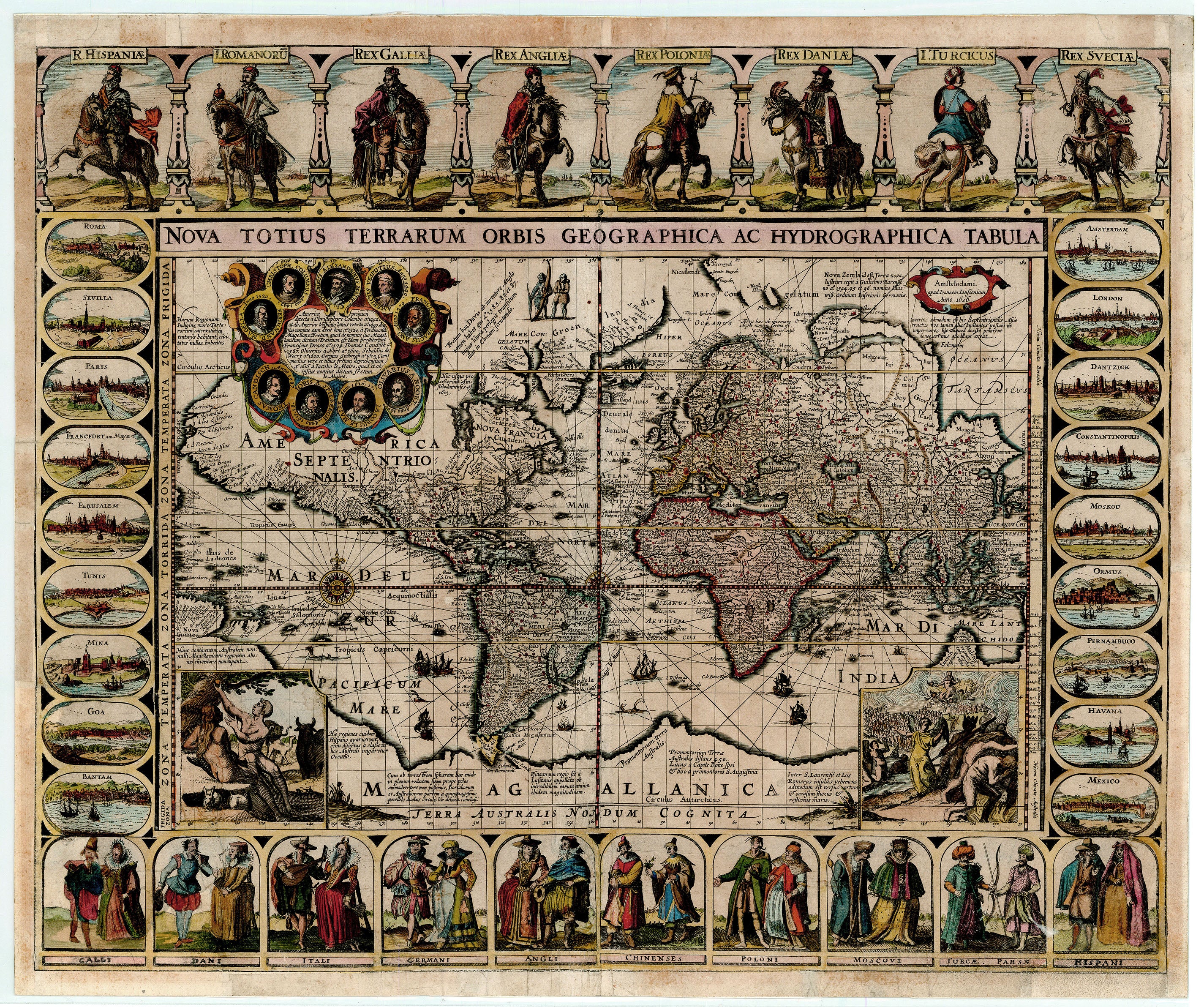
Planisphère: Levasseur c. 1840
- Title: Planisphère
- Author: Victor Levasseur
- Date: c. 1840
- Medium: Hand-colored steel engraving
- Condition: Very Good - age toning and minor tears in margins
- Inches: 20 3/8 x 14 [Paper]
- Centimeters: 51.75 x 35.56 [Paper]
- Product ID: 100633
World map from the Atlas Illustrè by Victor Levasseur.
Includes marginal decorations depicting astrological images and characters embodying the four seasons. Instructive text below the map notes major countries and regions within each of the continents.
Victor Levasseur (1800–1870) was a renowned French engineer, cartographer, and engraver active during the mid-19th century. He is best known for his Atlas National Illustré des 86 Départements et des Possessions de la France, first published in 1845, as well as his celebrated Atlas Illustre of 1847. Levasseur’s work is particularly distinctive for its wide decorative margins, which feature elaborate illustrations depicting the scenery, people, and trade goods associated with the regions he mapped. These artistic embellishments, often allegorical or symbolic, set his maps apart from those of his contemporaries and made them highly sought after by collectors and historians.
Description
- Title: Planisphère
- Author: Victor Levasseur
- Date: c. 1840
- Medium: Hand-colored steel engraving
- Condition: Very Good - age toning and minor tears in margins
- Inches: 20 3/8 x 14 [Paper]
- Centimeters: 51.75 x 35.56 [Paper]
- Product ID: 100633
World map from the Atlas Illustrè by Victor Levasseur.
Includes marginal decorations depicting astrological images and characters embodying the four seasons. Instructive text below the map notes major countries and regions within each of the continents.
Victor Levasseur (1800–1870) was a renowned French engineer, cartographer, and engraver active during the mid-19th century. He is best known for his Atlas National Illustré des 86 Départements et des Possessions de la France, first published in 1845, as well as his celebrated Atlas Illustre of 1847. Levasseur’s work is particularly distinctive for its wide decorative margins, which feature elaborate illustrations depicting the scenery, people, and trade goods associated with the regions he mapped. These artistic embellishments, often allegorical or symbolic, set his maps apart from those of his contemporaries and made them highly sought after by collectors and historians.