Mappemonde a l'Usage du Roy: Covens & Mortier / Delisle 1760
- Author: Covens & Mortier / Delisle
- Date: 1760
- Medium: Hand Colored Copperplate Engraving
-
Condition:
Printed on three joined sheets. Contemporary color on watermarked paper with minor soiling, most of it confined to the blank margins, and a few marginal edge tears that have been archivally repaired on verso.
- Inches: 26 x 17
- Centimeters: 65.8 x 43.4
- Product ID: 308047
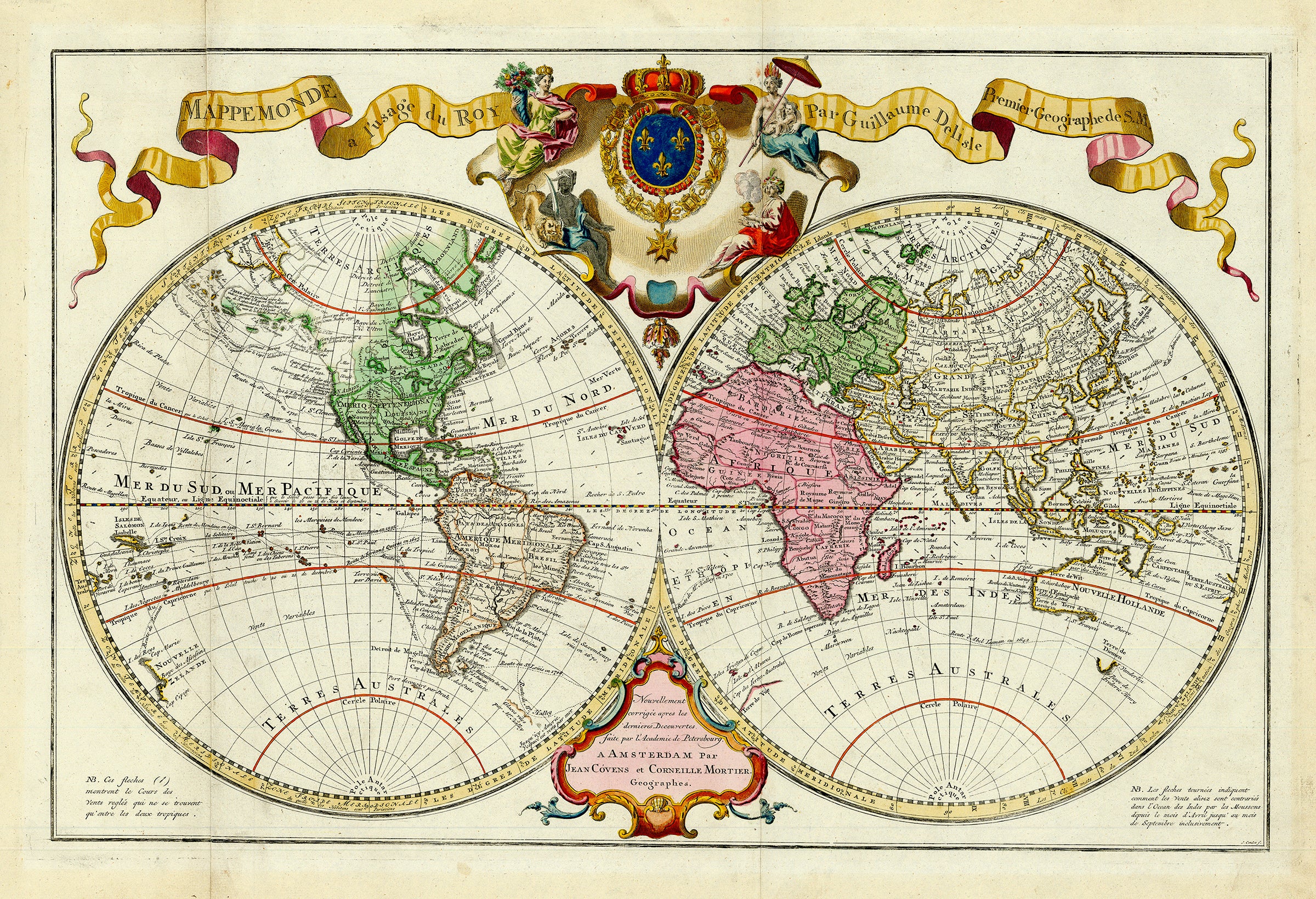
Covens and Mortier issued this double-hemisphere world map based on the combined work of Delisle and Buache. The routes of numerous explorers are noted, including Magellan (1520), St. Louis (1708), and numerous others. The colonies are recognizable on the eastern seaboard of North America, with Louisiane dominating the interior. The western portion of North America remains predominately blank, save for a large representation of the Mer de l'Ouest or Sea of the West. The Northwest coastline of the continent features some explorers notes and much conjecture as to the shape of the geography, ultimately depicting an irregularly shaped peninsula where Alaska should be.
- Author: Covens & Mortier / Delisle
- Date: 1760
- Medium: Hand Colored Copperplate Engraving
-
Condition:
Printed on three joined sheets. Contemporary color on watermarked paper with minor soiling, most of it confined to the blank margins, and a few marginal edge tears that have been archivally repaired on verso.
- Inches: 26 x 17
- Centimeters: 65.8 x 43.4
- Product ID: 308047
Covens and Mortier issued this double-hemisphere world map based on the combined work of Delisle and Buache. The routes of numerous explorers are noted, including Magellan (1520), St. Louis (1708), and numerous others. The colonies are recognizable on the eastern seaboard of North America, with Louisiane dominating the interior. The western portion of North America remains predominately blank, save for a large representation of the Mer de l'Ouest or Sea of the West. The Northwest coastline of the continent features some explorers notes and much conjecture as to the shape of the geography, ultimately depicting an irregularly shaped peninsula where Alaska should be.
Description
- Author: Covens & Mortier / Delisle
- Date: 1760
- Medium: Hand Colored Copperplate Engraving
-
Condition:
Printed on three joined sheets. Contemporary color on watermarked paper with minor soiling, most of it confined to the blank margins, and a few marginal edge tears that have been archivally repaired on verso.
- Inches: 26 x 17
- Centimeters: 65.8 x 43.4
- Product ID: 308047
Covens and Mortier issued this double-hemisphere world map based on the combined work of Delisle and Buache. The routes of numerous explorers are noted, including Magellan (1520), St. Louis (1708), and numerous others. The colonies are recognizable on the eastern seaboard of North America, with Louisiane dominating the interior. The western portion of North America remains predominately blank, save for a large representation of the Mer de l'Ouest or Sea of the West. The Northwest coastline of the continent features some explorers notes and much conjecture as to the shape of the geography, ultimately depicting an irregularly shaped peninsula where Alaska should be.