Mappe-Monde: Brue, 1816
- Title: Mappe-Monde en deux Hemisphere
- Author: Adrien-Hubert Brue
- Date: 1816
- Condition: See description
- Inches: 26 3/4 x 15 1/4 [Platemark]
- Centimeters: 67.94 x 38.73 [Platemark]
- Product ID: 308286
Scarce World Map on Mercator’s Projection
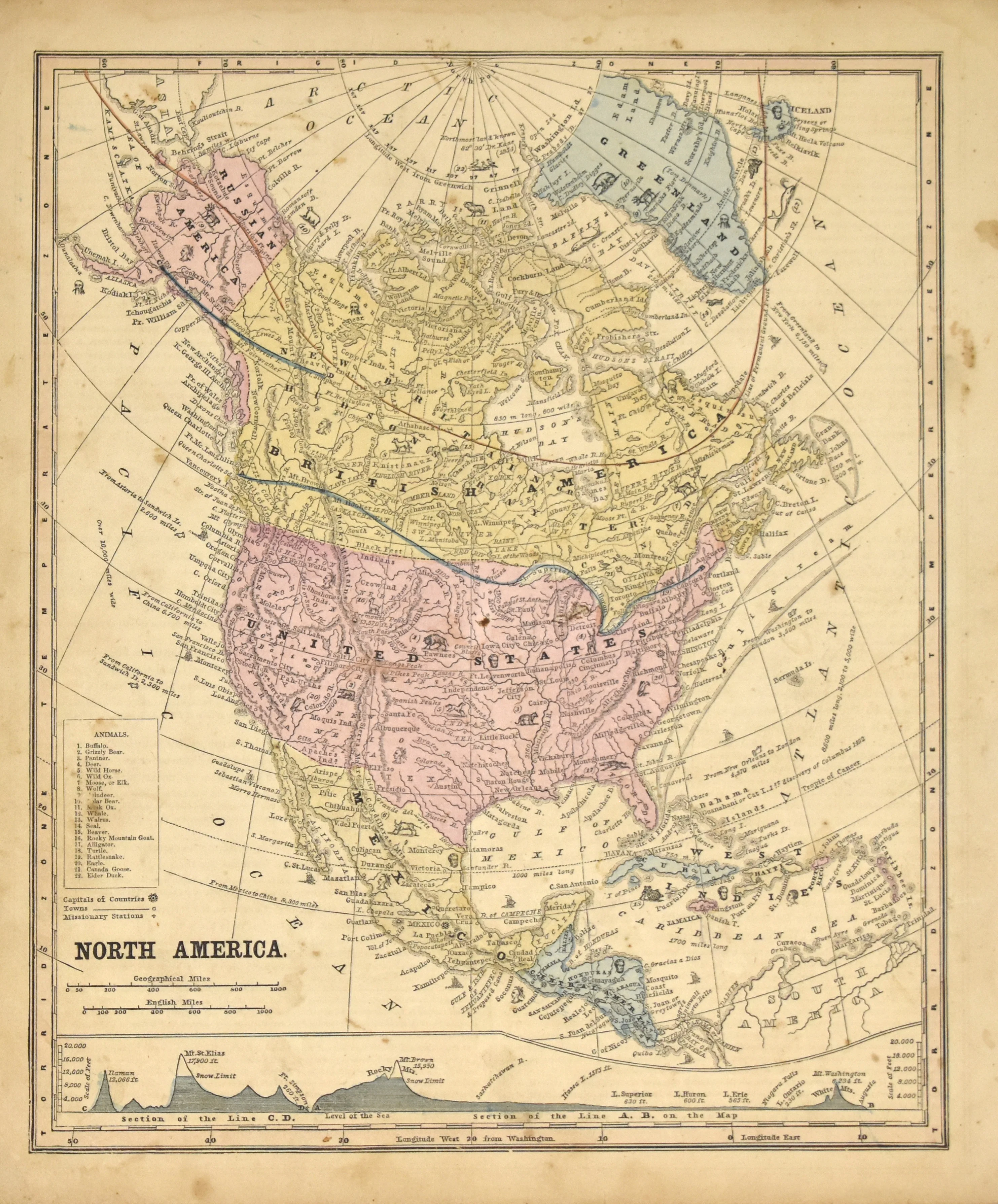
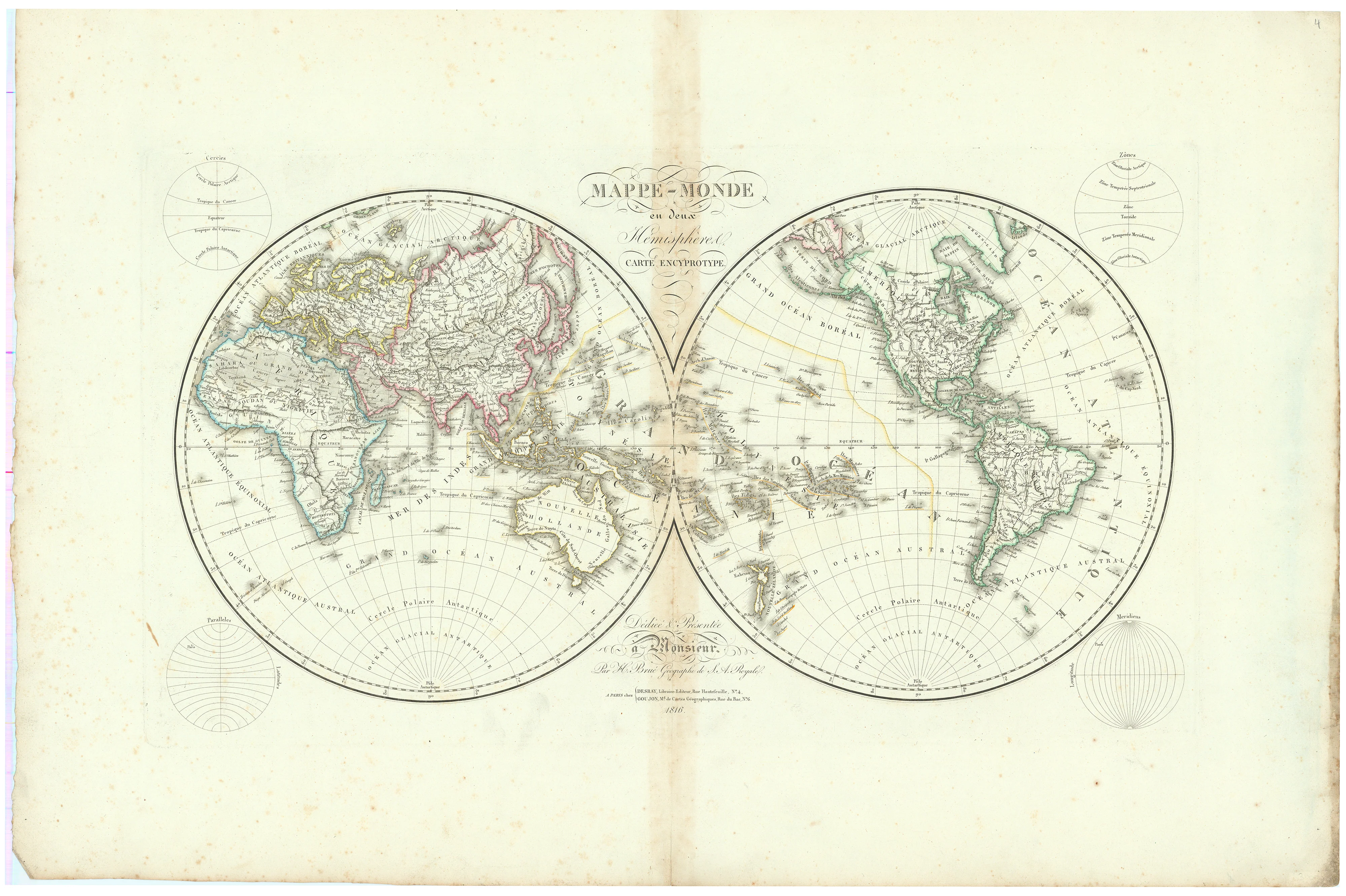
This detailed double hemisphere world map is from Brué’s Grand Atlas Universel, published in Paris by Desray and Goujon 1816. Large, hand-colored engraved map, French toponyms. With suspect topographic detail in North America, disregarding the map of Lewis and Clark published only three years earlier. Shows only a handful of cities in the interior of western North America including Santa Fe and New Orleans. Although political boundaries are not indicated, the map appears to limit the United States to east of the Mississippi, shows the Louisiana Purchase as simply LOUISIANE.
The map is notable for its detailed depiction of the world, including regions like Australia, where it shows the southern coast in detail, as well as the Pacific Ocean with many of the islands in the region named. Antarctica not shown, awaiting the surveys and mapping by James Clark Ross, a British Royal Navy officer. His expedition, which took place from 1839 to 1843, included the first magnetic survey of the Antarctic and inferred the location of the magnetic south pole.
This map exemplifies Brué's skill in cartography, highlighting both the artistic and scientific aspects of mapmaking during the period.
Background on Creator
Adrien-Hubert Brué (1786 – 1832) made significant contributions to geographical mapping through his detailed and accurate cartographic work. He began his career in cartography after serving on various ships, including the Baudin Expedition to the South Pacific. Brué's maps were known for their clarity and precision, which earned him the prestigious title of Geographe du Roi. In this capacity, he contributed to thousands of maps and numerous atlases. One of his notable works is the Grand Atlas Universel, published in 1816, which included 50 large-scale maps of all continents, showcasing his comprehensive approach to mapping.
Brué’s maps continued to be influential even after his death, with updates and republications occurring decades later. His widow initially published several maps posthumously before selling his work to his partner's heir, ensuring that Brué's contributions to cartography endured well beyond his lifetime.
Condition
Scattered stains, mild foxing. Slight discoloration at central fold. Very good.
- Title: Mappe-Monde en deux Hemisphere
- Author: Adrien-Hubert Brue
- Date: 1816
- Condition: See description
- Inches: 26 3/4 x 15 1/4 [Platemark]
- Centimeters: 67.94 x 38.73 [Platemark]
- Product ID: 308286
Scarce World Map on Mercator’s Projection
This detailed double hemisphere world map is from Brué’s Grand Atlas Universel, published in Paris by Desray and Goujon 1816. Large, hand-colored engraved map, French toponyms. With suspect topographic detail in North America, disregarding the map of Lewis and Clark published only three years earlier. Shows only a handful of cities in the interior of western North America including Santa Fe and New Orleans. Although political boundaries are not indicated, the map appears to limit the United States to east of the Mississippi, shows the Louisiana Purchase as simply LOUISIANE.
The map is notable for its detailed depiction of the world, including regions like Australia, where it shows the southern coast in detail, as well as the Pacific Ocean with many of the islands in the region named. Antarctica not shown, awaiting the surveys and mapping by James Clark Ross, a British Royal Navy officer. His expedition, which took place from 1839 to 1843, included the first magnetic survey of the Antarctic and inferred the location of the magnetic south pole.
This map exemplifies Brué's skill in cartography, highlighting both the artistic and scientific aspects of mapmaking during the period.
Background on Creator
Adrien-Hubert Brué (1786 – 1832) made significant contributions to geographical mapping through his detailed and accurate cartographic work. He began his career in cartography after serving on various ships, including the Baudin Expedition to the South Pacific. Brué's maps were known for their clarity and precision, which earned him the prestigious title of Geographe du Roi. In this capacity, he contributed to thousands of maps and numerous atlases. One of his notable works is the Grand Atlas Universel, published in 1816, which included 50 large-scale maps of all continents, showcasing his comprehensive approach to mapping.
Brué’s maps continued to be influential even after his death, with updates and republications occurring decades later. His widow initially published several maps posthumously before selling his work to his partner's heir, ensuring that Brué's contributions to cartography endured well beyond his lifetime.
Condition
Scattered stains, mild foxing. Slight discoloration at central fold. Very good.
Original: $995.00
-65%$995.00
$348.25Description
- Title: Mappe-Monde en deux Hemisphere
- Author: Adrien-Hubert Brue
- Date: 1816
- Condition: See description
- Inches: 26 3/4 x 15 1/4 [Platemark]
- Centimeters: 67.94 x 38.73 [Platemark]
- Product ID: 308286
Scarce World Map on Mercator’s Projection
This detailed double hemisphere world map is from Brué’s Grand Atlas Universel, published in Paris by Desray and Goujon 1816. Large, hand-colored engraved map, French toponyms. With suspect topographic detail in North America, disregarding the map of Lewis and Clark published only three years earlier. Shows only a handful of cities in the interior of western North America including Santa Fe and New Orleans. Although political boundaries are not indicated, the map appears to limit the United States to east of the Mississippi, shows the Louisiana Purchase as simply LOUISIANE.
The map is notable for its detailed depiction of the world, including regions like Australia, where it shows the southern coast in detail, as well as the Pacific Ocean with many of the islands in the region named. Antarctica not shown, awaiting the surveys and mapping by James Clark Ross, a British Royal Navy officer. His expedition, which took place from 1839 to 1843, included the first magnetic survey of the Antarctic and inferred the location of the magnetic south pole.
This map exemplifies Brué's skill in cartography, highlighting both the artistic and scientific aspects of mapmaking during the period.
Background on Creator
Adrien-Hubert Brué (1786 – 1832) made significant contributions to geographical mapping through his detailed and accurate cartographic work. He began his career in cartography after serving on various ships, including the Baudin Expedition to the South Pacific. Brué's maps were known for their clarity and precision, which earned him the prestigious title of Geographe du Roi. In this capacity, he contributed to thousands of maps and numerous atlases. One of his notable works is the Grand Atlas Universel, published in 1816, which included 50 large-scale maps of all continents, showcasing his comprehensive approach to mapping.
Brué’s maps continued to be influential even after his death, with updates and republications occurring decades later. His widow initially published several maps posthumously before selling his work to his partner's heir, ensuring that Brué's contributions to cartography endured well beyond his lifetime.
Condition
Scattered stains, mild foxing. Slight discoloration at central fold. Very good.