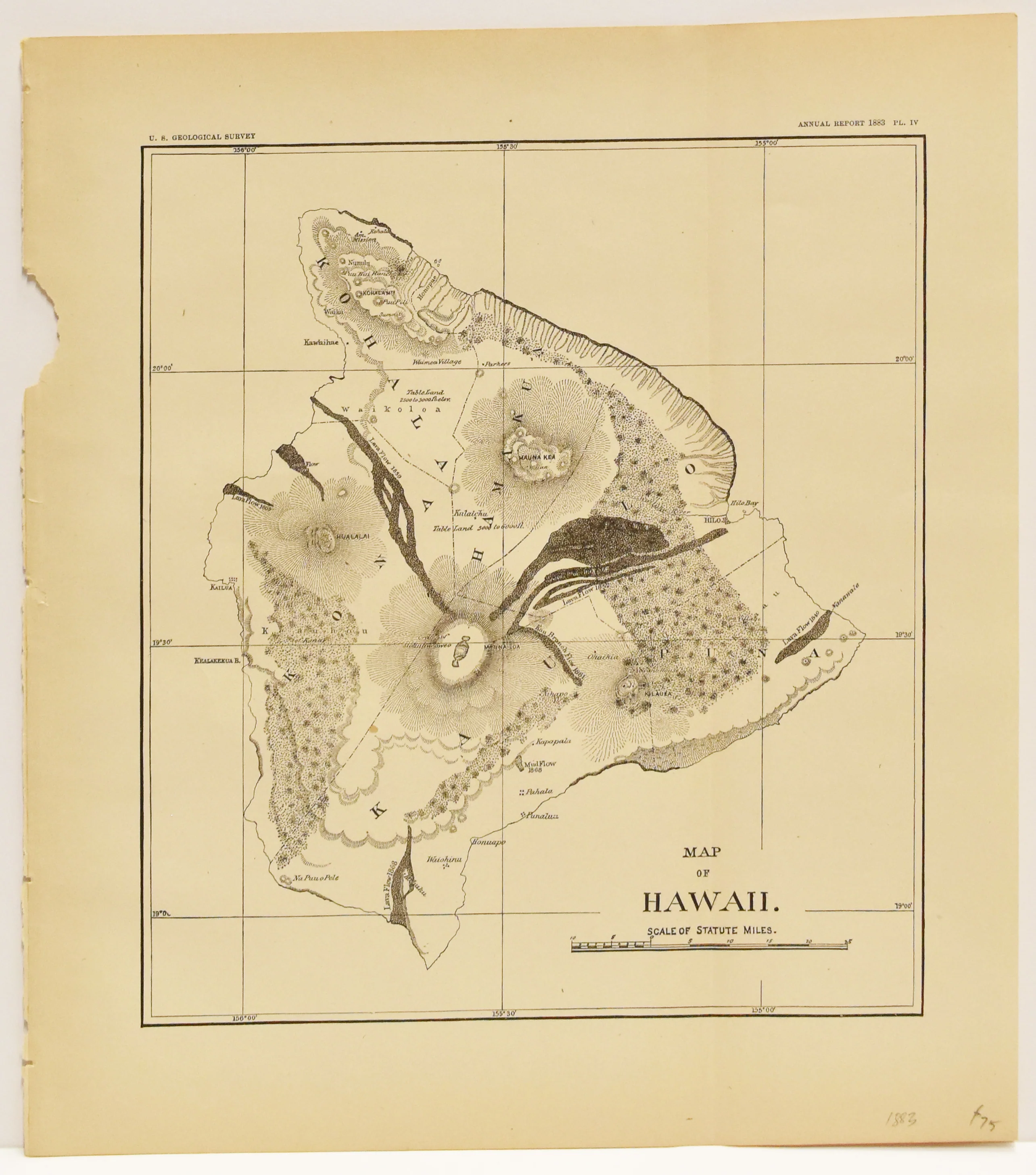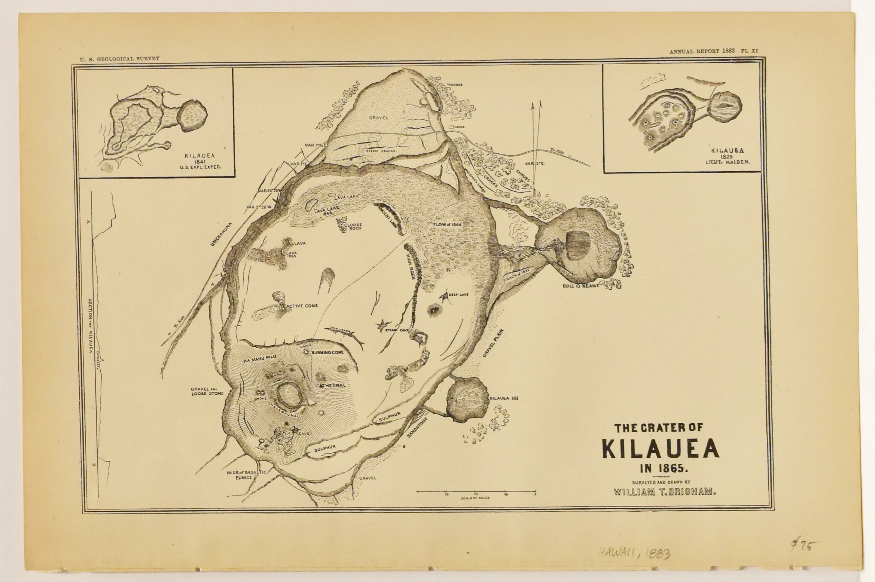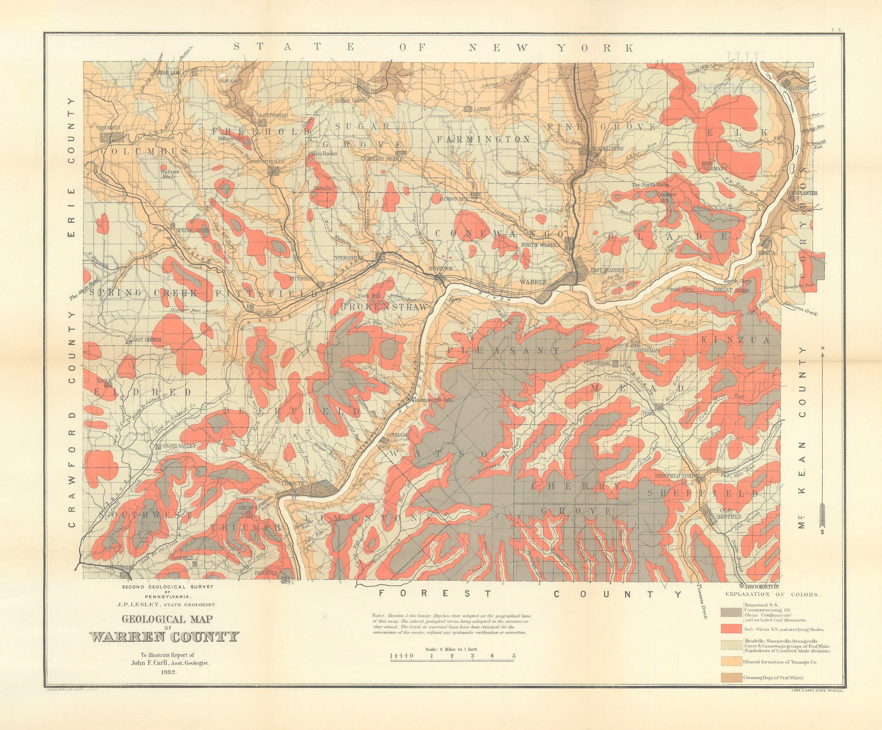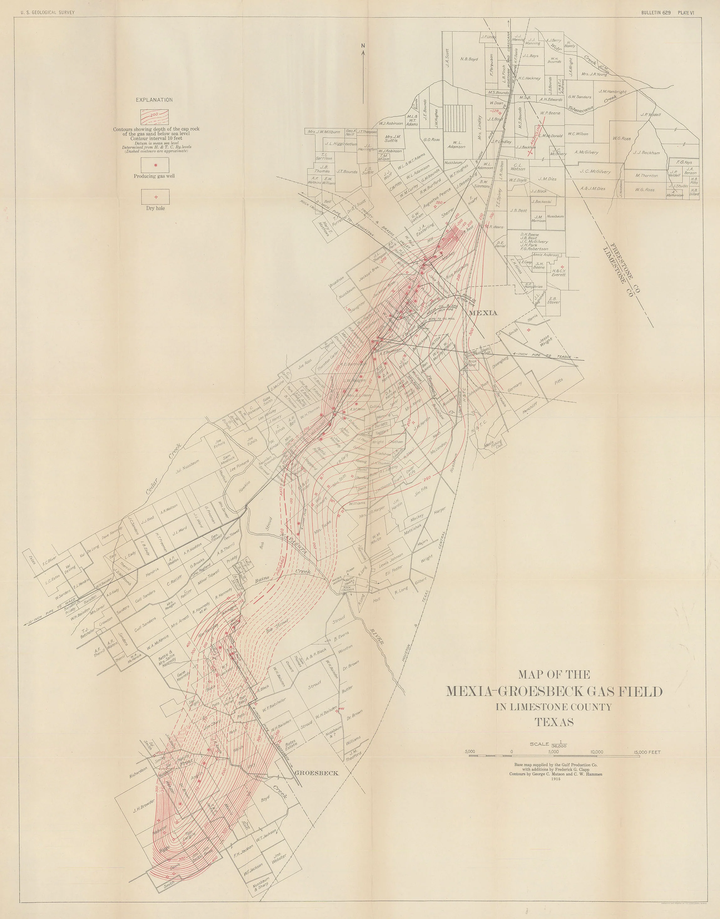
Map of the Mexia-Groesbeck Gas Field in Limestone County Texas: U. S. Geological Survey 1915
- Title: Map of the Mexia-Groesbeck Gas Field in Limestone County Texas
- Author: U. S. Geological Survey
- Date: 1915
- Medium: Chromolithograph
- Condition: Very Good - age toning, light wear along fold lines, minor separations at some folds, creasing
- Inches: 28 3/4 x 36 1/2 [Paper]
- Centimeters: 73.03 x 92.71 [Paper]
- Product ID: 100068
The U.S. Geological Survey (USGS) is a scientific agency within the U.S. Department of the Interior. The USGS is the nation's largest water, earth, and biological science and civilian mapping agency. It collects, monitors, analyzes, and provides scientific understanding of natural resource conditions, issues, and problems.
The USGS was founded in 1879 by President Rutherford B. Hayes. The agency's original mission was to study the landscape of the United States, its natural resources, and the natural hazards that threaten it. Today, the USGS continues to conduct research in these areas, but it also has a broader mission to provide scientific information and services to the American people.
Description
- Title: Map of the Mexia-Groesbeck Gas Field in Limestone County Texas
- Author: U. S. Geological Survey
- Date: 1915
- Medium: Chromolithograph
- Condition: Very Good - age toning, light wear along fold lines, minor separations at some folds, creasing
- Inches: 28 3/4 x 36 1/2 [Paper]
- Centimeters: 73.03 x 92.71 [Paper]
- Product ID: 100068
The U.S. Geological Survey (USGS) is a scientific agency within the U.S. Department of the Interior. The USGS is the nation's largest water, earth, and biological science and civilian mapping agency. It collects, monitors, analyzes, and provides scientific understanding of natural resource conditions, issues, and problems.
The USGS was founded in 1879 by President Rutherford B. Hayes. The agency's original mission was to study the landscape of the United States, its natural resources, and the natural hazards that threaten it. Today, the USGS continues to conduct research in these areas, but it also has a broader mission to provide scientific information and services to the American people.