Galveston to Rio Grande: U. S. Coast and Geodetic Survey 1965
- Title: Galveston to Rio Grande
- Author: U. S. Coast and Geodetic Survey
- Date: 1965
- Medium: Chromolithograph
- Condition: Very Good Plus - light age toning and foxing, issued horizontal center fold, minor creasing and paper loss in margins, areas of discoloration
- Inches: 36 x 43 [Paper]
- Centimeters: 91.44 x 109.22 [Paper]
- Product ID: 318053
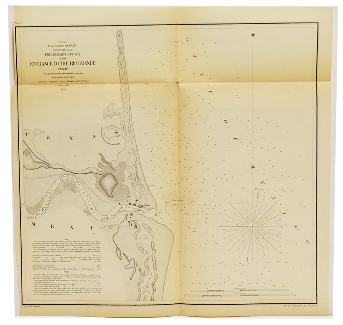
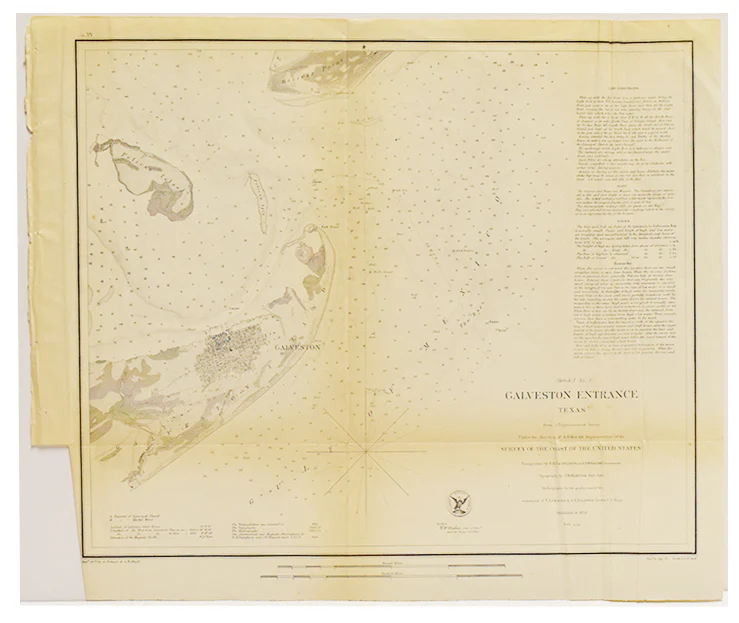
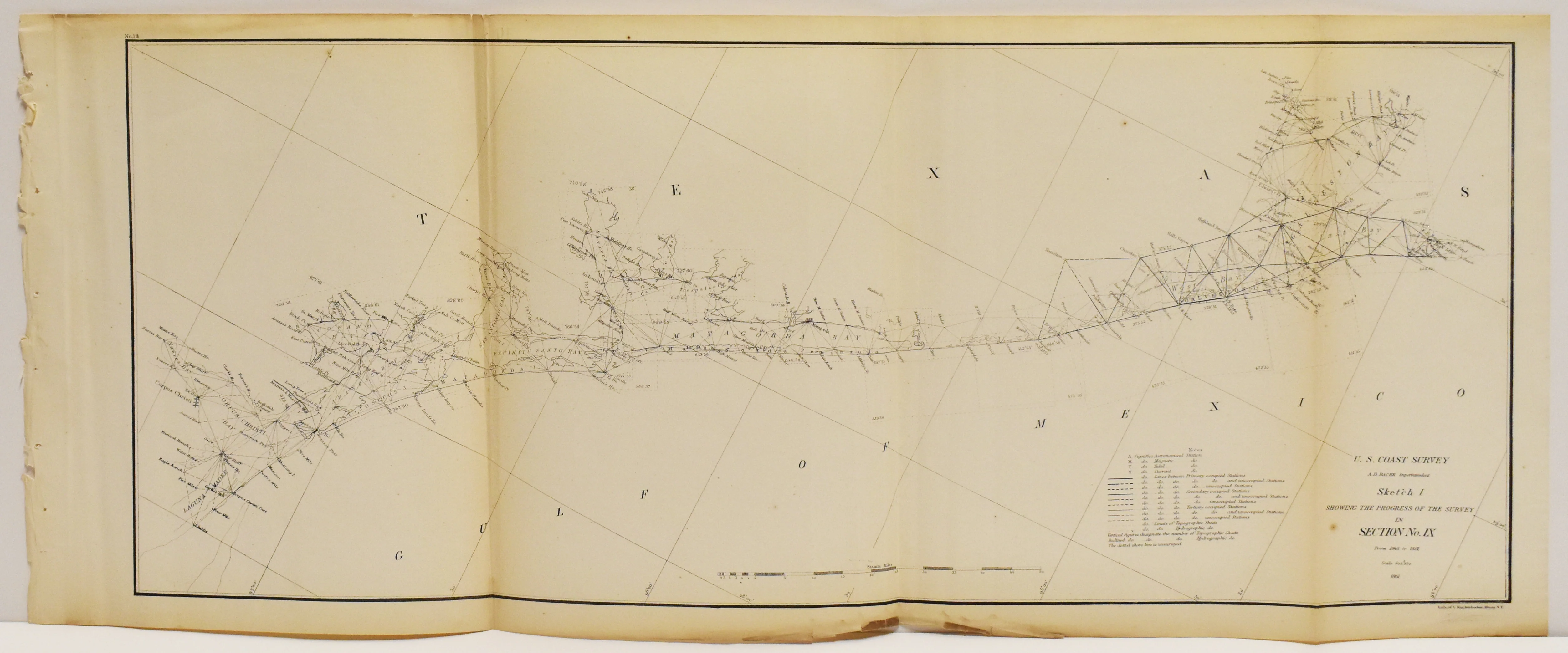
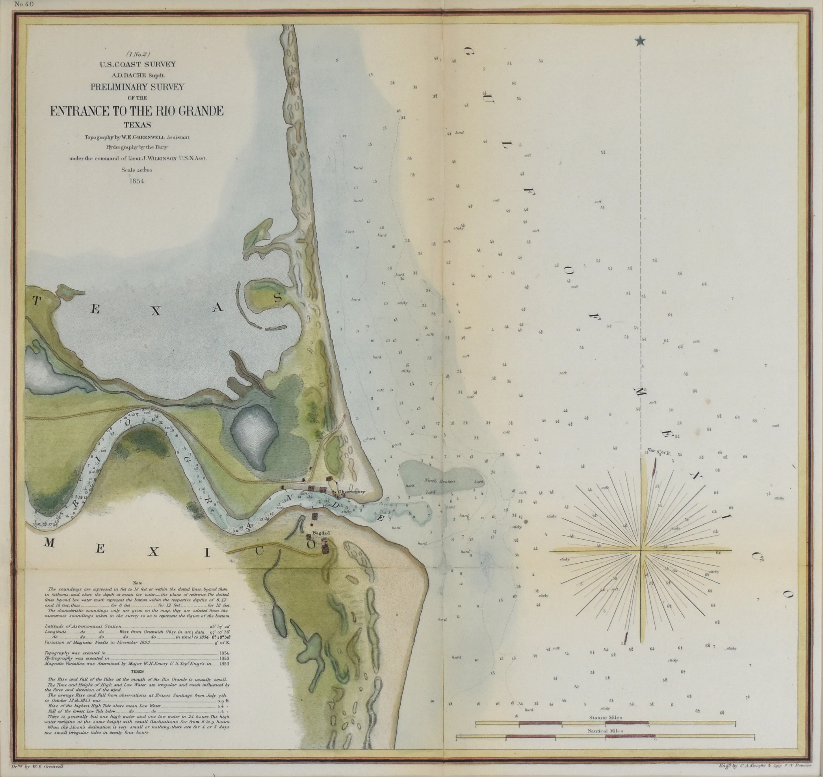
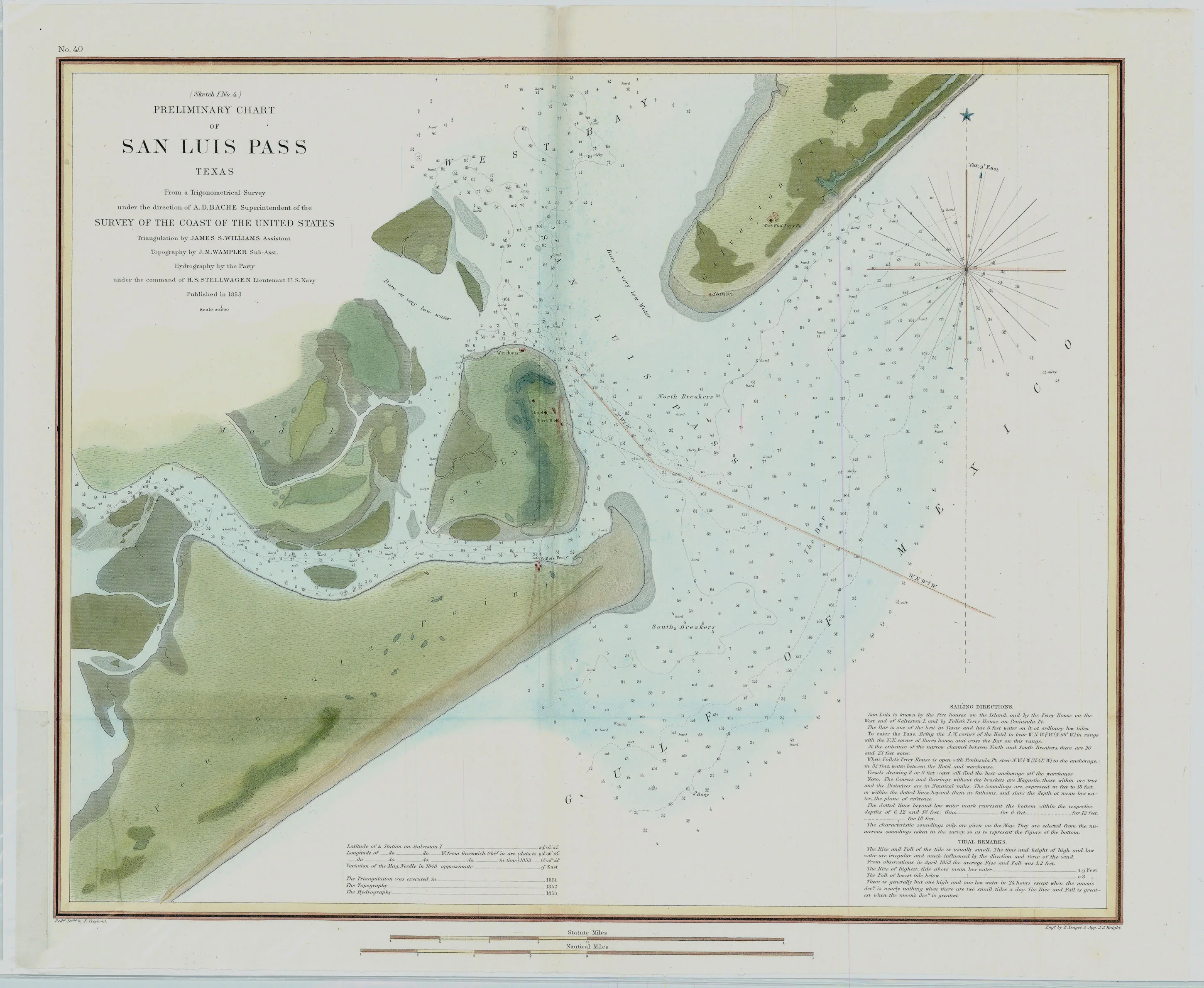
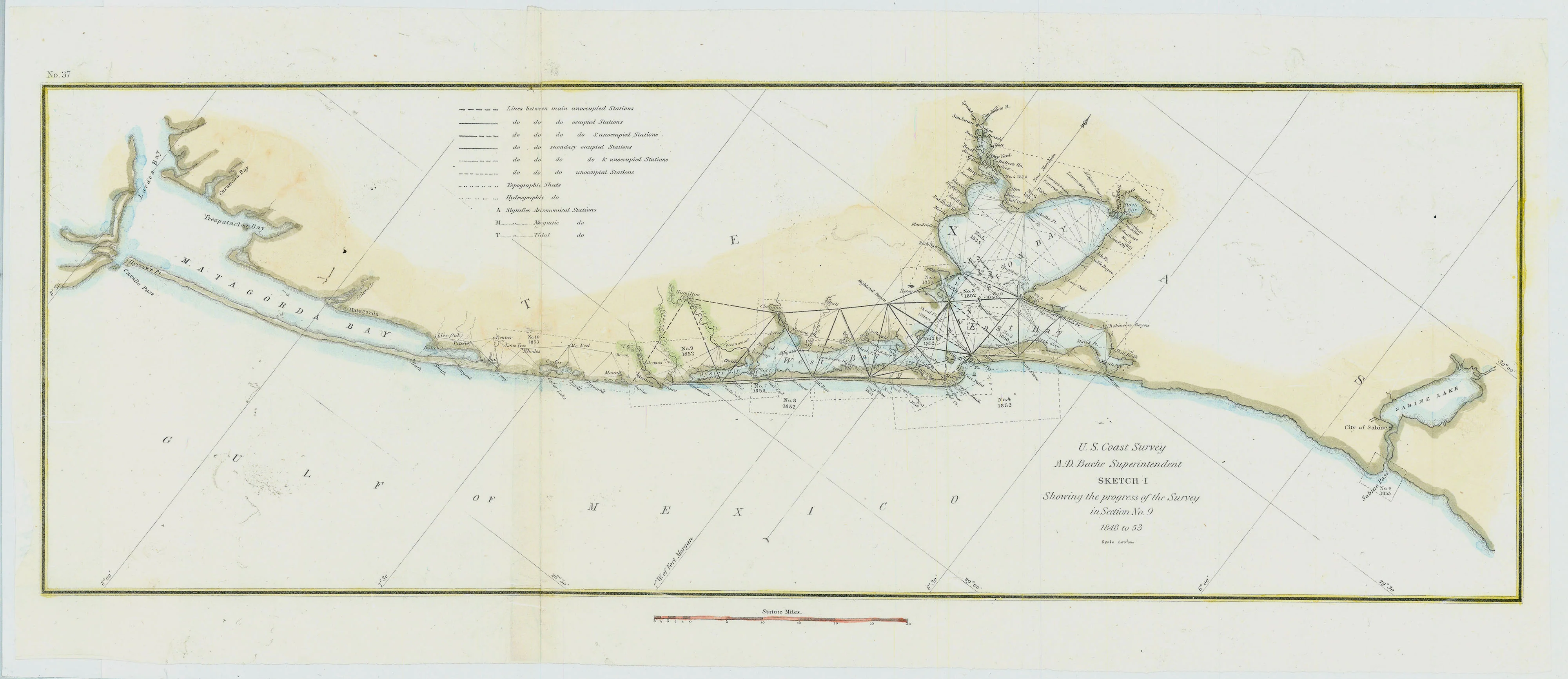
Map of the Texas Gulf Coast from Galveston Bay to the mouth of the Rio Grande River at the Mexican border. Depicts Galveston Island, Bolivar Peninsula, the Houston Ship Channel, Trinity Bay, the Intracoastal Waterway, Matagorda Bay, Aransas Pass, Laguna Madre, and Corpus Christi Bay. Also includes the cities of Houston, Galveston, Texas City, Richmond, Victoria, Goliad, Rockport, Corpus Christi, and Brownsville, among others. Map shows the railroad network of the region and lists information related to oil pipelines and wells, water depths, magnetic variation, tides and currents, and climate and terrain.
- Title: Galveston to Rio Grande
- Author: U. S. Coast and Geodetic Survey
- Date: 1965
- Medium: Chromolithograph
- Condition: Very Good Plus - light age toning and foxing, issued horizontal center fold, minor creasing and paper loss in margins, areas of discoloration
- Inches: 36 x 43 [Paper]
- Centimeters: 91.44 x 109.22 [Paper]
- Product ID: 318053
Map of the Texas Gulf Coast from Galveston Bay to the mouth of the Rio Grande River at the Mexican border. Depicts Galveston Island, Bolivar Peninsula, the Houston Ship Channel, Trinity Bay, the Intracoastal Waterway, Matagorda Bay, Aransas Pass, Laguna Madre, and Corpus Christi Bay. Also includes the cities of Houston, Galveston, Texas City, Richmond, Victoria, Goliad, Rockport, Corpus Christi, and Brownsville, among others. Map shows the railroad network of the region and lists information related to oil pipelines and wells, water depths, magnetic variation, tides and currents, and climate and terrain.
Description
- Title: Galveston to Rio Grande
- Author: U. S. Coast and Geodetic Survey
- Date: 1965
- Medium: Chromolithograph
- Condition: Very Good Plus - light age toning and foxing, issued horizontal center fold, minor creasing and paper loss in margins, areas of discoloration
- Inches: 36 x 43 [Paper]
- Centimeters: 91.44 x 109.22 [Paper]
- Product ID: 318053
Map of the Texas Gulf Coast from Galveston Bay to the mouth of the Rio Grande River at the Mexican border. Depicts Galveston Island, Bolivar Peninsula, the Houston Ship Channel, Trinity Bay, the Intracoastal Waterway, Matagorda Bay, Aransas Pass, Laguna Madre, and Corpus Christi Bay. Also includes the cities of Houston, Galveston, Texas City, Richmond, Victoria, Goliad, Rockport, Corpus Christi, and Brownsville, among others. Map shows the railroad network of the region and lists information related to oil pipelines and wells, water depths, magnetic variation, tides and currents, and climate and terrain.