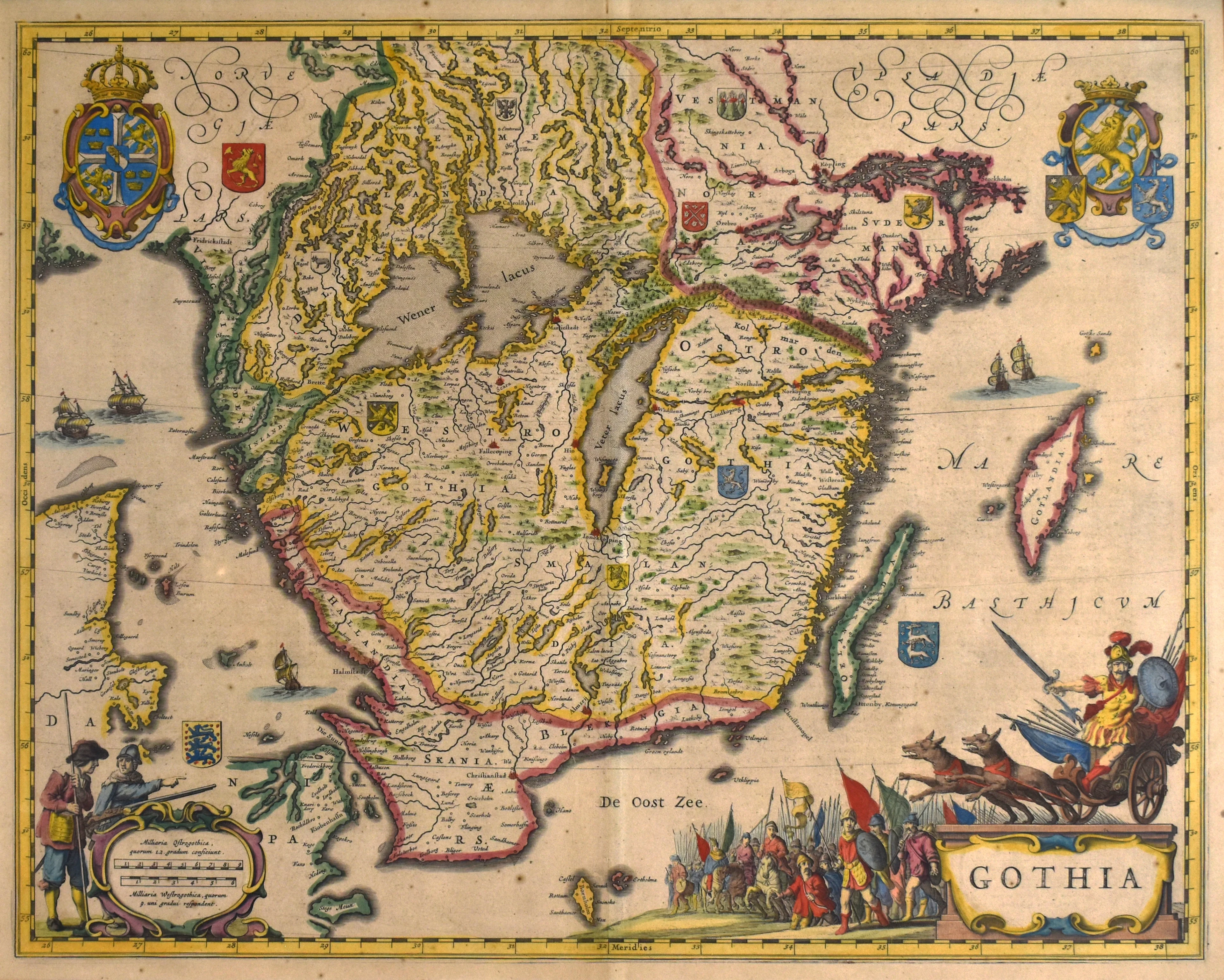
Insula Corsica olim Regent Titulo Insignis: Seutter 1728
- Title: Insula Corsica olim Regent Titulo Insignis
- Author: Matthäus Seutter
- Date: 1728
- Medium: Hand-Colored Copperplate Engraving
- Condition: Very Good Plus
- Inches: 19.75 x 23 [Image]
- Centimeters: 50 x 58.4 [Image]
- Product ID: 224028
Insula Corsica olim Regent Titulo Insignisnune Genuensis Reipublicae poteftati fubjecta, juxta recentifsimam designationem mapp Geographica aeri incefa..."
This beautiful antique hand-colored map depicting the island of Corsica was published by German brewer-turned-map-publisher Matthäus Seutter in 1728. Though map making was not his first profession, Seutter excelled in the business, becoming one of the most prolific publishers of his time. In 1727 he became Imperial Geographer to German Emperor Charles VI.
Description
- Title: Insula Corsica olim Regent Titulo Insignis
- Author: Matthäus Seutter
- Date: 1728
- Medium: Hand-Colored Copperplate Engraving
- Condition: Very Good Plus
- Inches: 19.75 x 23 [Image]
- Centimeters: 50 x 58.4 [Image]
- Product ID: 224028
Insula Corsica olim Regent Titulo Insignisnune Genuensis Reipublicae poteftati fubjecta, juxta recentifsimam designationem mapp Geographica aeri incefa..."
This beautiful antique hand-colored map depicting the island of Corsica was published by German brewer-turned-map-publisher Matthäus Seutter in 1728. Though map making was not his first profession, Seutter excelled in the business, becoming one of the most prolific publishers of his time. In 1727 he became Imperial Geographer to German Emperor Charles VI.