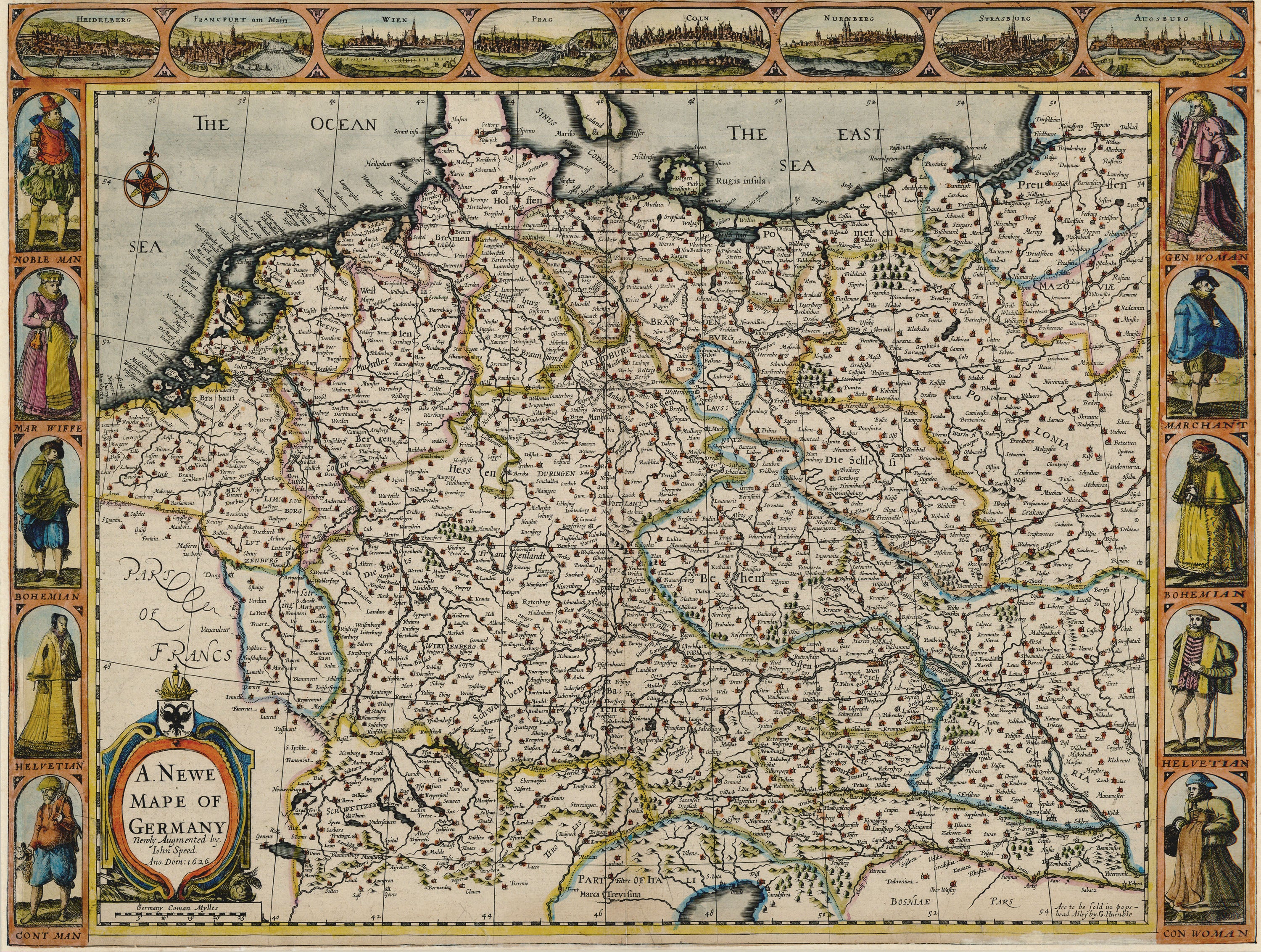
A New Map of the Circle of Franconia: Cary 1799
- Title: A New Map of the Circle of Franconia
- Author: John Cary
- Date: 1799
- Medium: Hand-colored copperplate engraving
- Condition: Very Good - light age toning, issued center fold, tide marks in margins
- Inches: 24 3/4 x 21 [Paper]
- Centimeters: 62.87 x 53.34 [Paper]
- Product ID: 100879
Map of central Germany showing the cities of Ingolstadt, Heidleberg, Nuremberg, and Frankfurt, among others.
Background on Creator
John Cary (c. 1754–1835) was a renowned English cartographer and engraver who set new standards for map clarity and accuracy in the late 18th and early 19th centuries. His influential works include "Cary’s New and Correct English Atlas" (1787) and "Cary’s New Universal Atlas" (1808), and he was appointed Surveyor of Roads to the General Post Office in 1794. Cary’s maps, known for their clean engraving and functional design, remain highly valued by collectors and historians.
Description
- Title: A New Map of the Circle of Franconia
- Author: John Cary
- Date: 1799
- Medium: Hand-colored copperplate engraving
- Condition: Very Good - light age toning, issued center fold, tide marks in margins
- Inches: 24 3/4 x 21 [Paper]
- Centimeters: 62.87 x 53.34 [Paper]
- Product ID: 100879
Map of central Germany showing the cities of Ingolstadt, Heidleberg, Nuremberg, and Frankfurt, among others.
Background on Creator
John Cary (c. 1754–1835) was a renowned English cartographer and engraver who set new standards for map clarity and accuracy in the late 18th and early 19th centuries. His influential works include "Cary’s New and Correct English Atlas" (1787) and "Cary’s New Universal Atlas" (1808), and he was appointed Surveyor of Roads to the General Post Office in 1794. Cary’s maps, known for their clean engraving and functional design, remain highly valued by collectors and historians.